File:Church of St Andrew, Witham on the Hill - geograph.org.uk - 203015.jpg
From Wikishire
No higher resolution available.
Church_of_St_Andrew,_Witham_on_the_Hill_-_geograph.org.uk_-_203015.jpg (640 × 480 pixels, file size: 83 KB, MIME type: image/jpeg)
Summary
| Description |
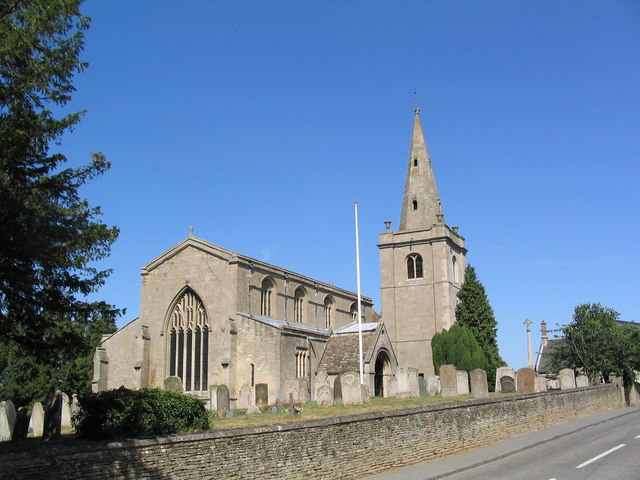
English: Church of St Andrew, Witham on the Hill. Earliest portions are mid 12th C. In 1736 the original tower and spire collapsed; the lives of the bell ringers being saved because they were taking a mid-session break at the local tavern. |
| Date | |
| Source | From geograph.org.uk |
| Author | Tim Heaton |
| Attribution (required by the license) | Tim Heaton / Church of St Andrew, Witham on the Hill / |
| Camera location | | View this and other nearby images on: OpenStreetMap |
|---|
_heading:45.00&language=en)
| Object location | | View this and other nearby images on: OpenStreetMap |
|---|
_heading:45.00&language=en)
Licensing

|
This image was taken from the Geograph project collection. See this photograph's page on the Geograph website for the photographer's contact details. The copyright on this image is owned by Tim Heaton and is licensed for reuse under the Creative Commons Attribution-ShareAlike 2.0 license.
|
This file is licensed under the Creative Commons Attribution-Share Alike 2.0 Generic license.
Attribution: Tim Heaton
- You are free:
- to share – to copy, distribute and transmit the work
- to remix – to adapt the work
- Under the following conditions:
- attribution – You must give appropriate credit, provide a link to the license, and indicate if changes were made. You may do so in any reasonable manner, but not in any way that suggests the licensor endorses you or your use.
- share alike – If you remix, transform, or build upon the material, you must distribute your contributions under the same or compatible license as the original.
File history
Click on a date/time to view the file as it appeared at that time.
| Date/Time | Thumbnail | Dimensions | User | Comment | |
|---|---|---|---|---|---|
| current | 17:44, 31 January 2010 | | 640 × 480 (83 KB) | GeographBot | == {{int:filedesc}} == {{Information |description={{en|1=Church of St Andrew, Witham on the Hill. Earliest portions are mid 12th C. In 1736 the original tower and spire collapsed; the lives of the bell ringers being saved because they were taking a mid-se |
File usage
The following file is a duplicate of this file (more details):
- File:Church of St Andrew, Witham on the Hill - geograph.org.uk - 203015.jpg from a shared repository
The following page links to this file: