File:Central.Britain.c550.jpg
From Wikishire
Size of this preview: 559 × 599 pixels. Other resolution: 224 × 240 pixels.
Original file (1,674 × 1,794 pixels, file size: 425 KB, MIME type: image/jpeg)
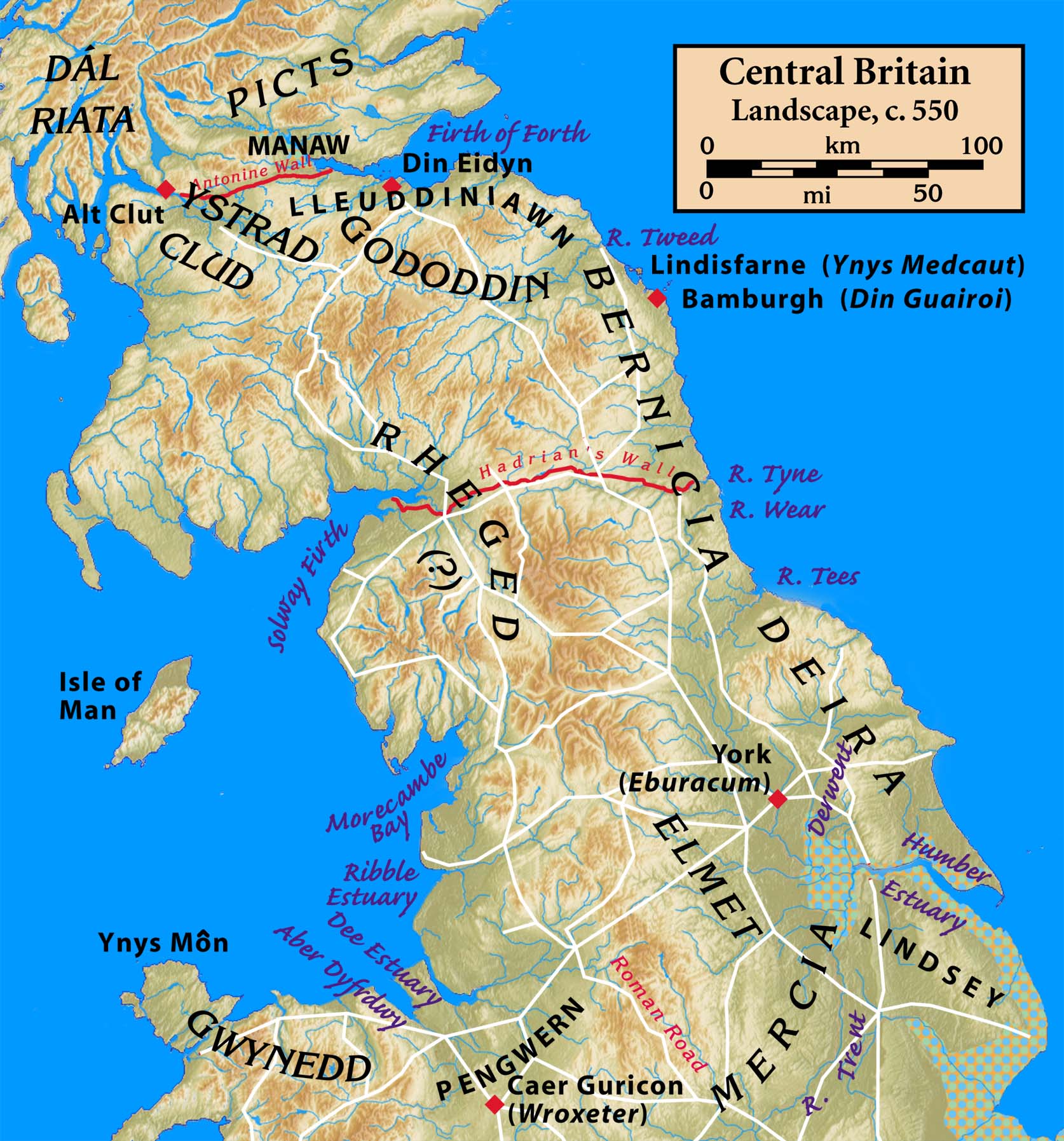
| Description | Central Britain, c. 550 | ||
| Date | |||
| Source | Peoples and places from public sources, including Celtic Culture: A Historical Encyclopedia, John T. Koch, ed. (2005), ISBN 9781851094400; major Roman roads from the Iter Britanniarum of the Antonine Itineraries, plus additions from other sources | ||
| Author | myself | ||
| Other versions |
|


I, the copyright holder of this work, hereby publish it under the following license:
This file is licensed under the Creative Commons Attribution-Share Alike 3.0 Unported license.
- You are free:
- to share – to copy, distribute and transmit the work
- to remix – to adapt the work
- Under the following conditions:
- attribution – You must give appropriate credit, provide a link to the license, and indicate if changes were made. You may do so in any reasonable manner, but not in any way that suggests the licensor endorses you or your use.
- share alike – If you remix, transform, or build upon the material, you must distribute your contributions under the same or compatible license as the original.
File history
Click on a date/time to view the file as it appeared at that time.
| Date/Time | Thumbnail | Dimensions | User | Comment | |
|---|---|---|---|---|---|
| current | 00:47, 23 August 2009 | | 1,674 × 1,794 (425 KB) | Notuncurious | {{Information |Description=Central Britain, c. 550 |Source=Peoples and places from public sources, including ''Celtic Culture: A Historical Encyclopedia'', John T. Koch, ed. (2005), isbn 9781851094400; major Roman roads from the ''Iter Britanniarum'' of t |
File usage
The following file is a duplicate of this file (more details):
- File:Central.Britain.c550.jpg from a shared repository
The following page links to this file: