File:Castle Acre Bailey Gate - geograph.org.uk - 1718512.jpg
From Wikishire
Size of this preview: 648 × 599 pixels. Other resolution: 260 × 240 pixels.
Original file (2,354 × 2,177 pixels, file size: 1.39 MB, MIME type: image/jpeg)
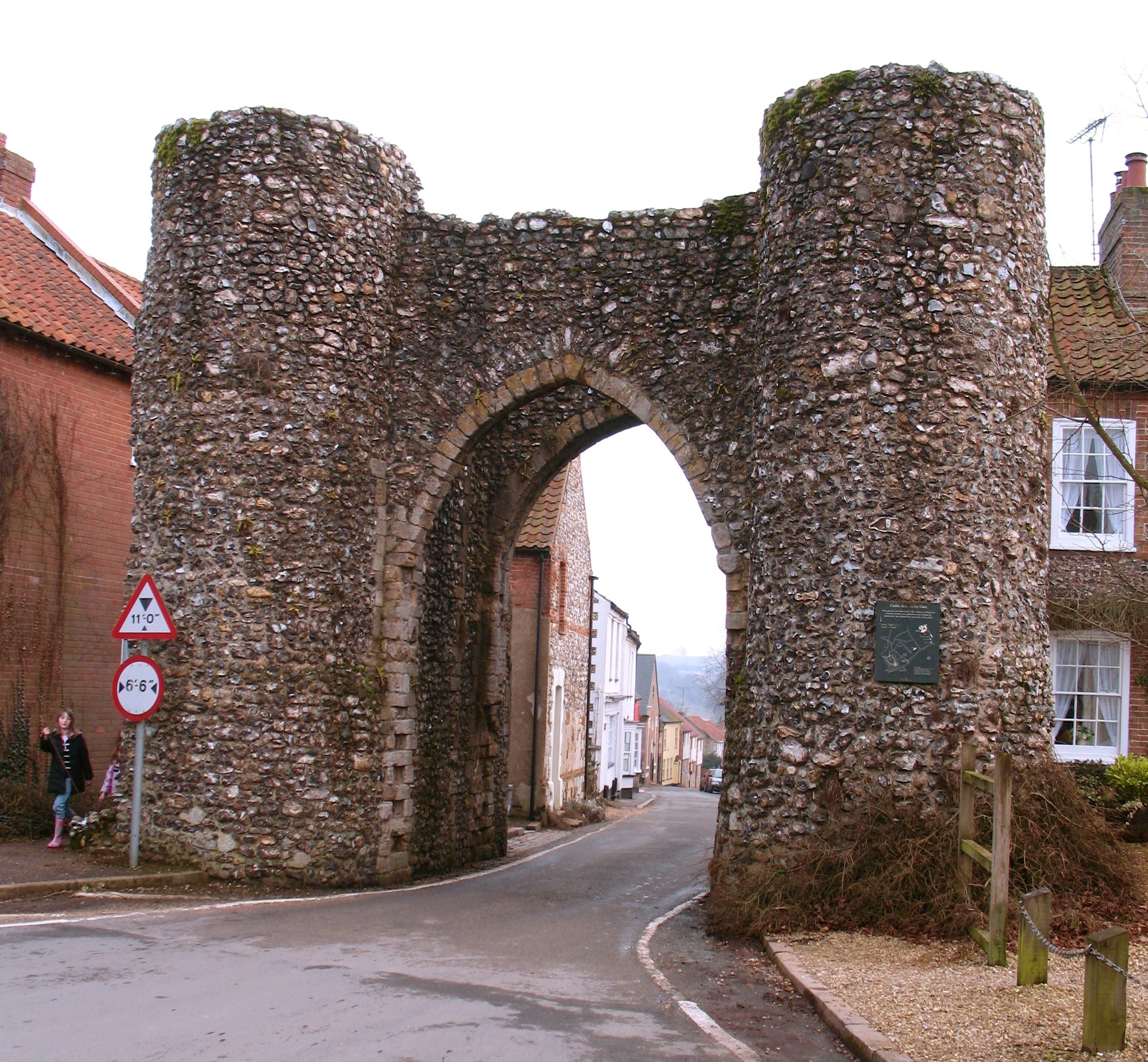
This is a photo of listed building number 1077681. |
Summary
| Description |
English: Castle Acre Bailey Gate Standing in the village High Street one would assume that this was once the gateway into the medieval town from the south, but this would be wrong as the original Norman walled settlement was to the south of the gate, stretching down the hillside towards the River Nar. |
| Date | |
| Source | From geograph.org.uk |
| Author | Gordon Hatton |
| Attribution (required by the license) | Gordon Hatton / Castle Acre Bailey Gate / |
| Camera location | | View this and other nearby images on: OpenStreetMap |
|---|
_heading:112.00&language=en)
| Object location | | View this and other nearby images on: OpenStreetMap |
|---|
_heading:112.00&language=en)
Licensing

|
This image was taken from the Geograph project collection. See this photograph's page on the Geograph website for the photographer's contact details. The copyright on this image is owned by Gordon Hatton and is licensed for reuse under the Creative Commons Attribution-ShareAlike 2.0 license.
|
This file is licensed under the Creative Commons Attribution-Share Alike 2.0 Generic license.
Attribution: Gordon Hatton
- You are free:
- to share – to copy, distribute and transmit the work
- to remix – to adapt the work
- Under the following conditions:
- attribution – You must give appropriate credit, provide a link to the license, and indicate if changes were made. You may do so in any reasonable manner, but not in any way that suggests the licensor endorses you or your use.
- share alike – If you remix, transform, or build upon the material, you must distribute your contributions under the same or compatible license as the original.
File history
Click on a date/time to view the file as it appeared at that time.
| Date/Time | Thumbnail | Dimensions | User | Comment | |
|---|---|---|---|---|---|
| current | 16:04, 18 August 2017 | | 2,354 × 2,177 (1.39 MB) | Hohum | Lighter |
File usage
The following file is a duplicate of this file (more details):
- File:Castle Acre Bailey Gate - geograph.org.uk - 1718512.jpg from a shared repository
The following page links to this file: