File:Cambridge Kings Ditch map.svg
From Wikishire

Size of this preview: 449 × 599 pixels. Other resolution: 180 × 240 pixels.
Original file (SVG file, nominally 512 × 683 pixels, file size: 184 KB)
Summary
| Description |
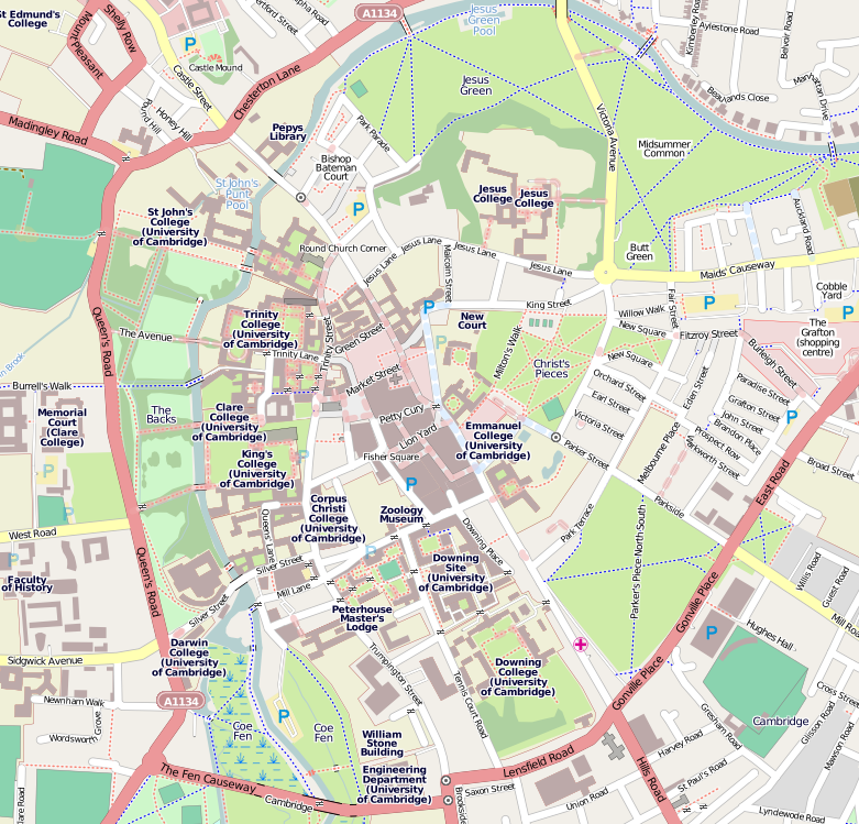
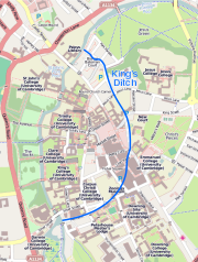
English: The location of King's Ditch overlaid on a modern map of Cambridge by CMG Lee. The modern map is from http://commons.wikimedia.org/wiki/File:Cambridge_centre_map.png and the location of the ditch is from http://british-history.ac.uk/rchme/cambs/xxxii-lviii and http://midsummercommon.org.uk/Papers/MidsummerCommon.pdf . |
|
| Date | 09:30, 15 May 2010 | |
| Source |
|
|
| Author | OpenStreetMap contributors, cmglee |
Licensing
This file is licensed under the Creative Commons Attribution-Share Alike 4.0 International license.
- You are free:
- to share – to copy, distribute and transmit the work
- to remix – to adapt the work
- Under the following conditions:
- attribution – You must give appropriate credit, provide a link to the license, and indicate if changes were made. You may do so in any reasonable manner, but not in any way that suggests the licensor endorses you or your use.
- share alike – If you remix, transform, or build upon the material, you must distribute your contributions under the same or compatible license as the original.
File history
Click on a date/time to view the file as it appeared at that time.
| Date/Time | Thumbnail | Dimensions | User | Comment | |
|---|---|---|---|---|---|
| current | 17:33, 17 October 2020 | | 512 × 683 (184 KB) | Cmglee | Add embedded image width and height to fix blank thumbnail. |
File usage
The following file is a duplicate of this file (more details):
- File:Cambridge Kings Ditch map.svg from a shared repository
The following page links to this file: