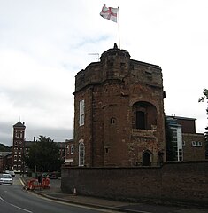
File:Caldwell Tower, Kidderminster (cropped).jpg
From Wikishire

Size of this preview: 587 × 599 pixels. Other resolution: 235 × 240 pixels.
Original file (2,304 × 2,352 pixels, file size: 396 KB, MIME type: image/jpeg)
.jpg)
| Description | |
| Date | |
| Source |
This file was derived from: Caldwell Tower, Kidderminster.jpg |
| Author |
|
| Camera location | | View this and other nearby images on: OpenStreetMap |
|---|
.jpg¶ms=052.383300_N_-002.248690_E_globe:Earth_type:camera_heading:225.00&language=en)
.jpg¶ms=52.382668511993_N_2.249714816698_W_region:GB_scale:25000)
| This is a retouched picture, which means that it has been digitally altered from its original version. Modifications: cropped and lightened. The original can be viewed here: Geograph-2058729-by-Richard-Rogerson.jpg:
|
This file is licensed under the Creative Commons Attribution-Share Alike 2.0 Generic license.
Attribution: Richard Rogerson
- You are free:
- to share – to copy, distribute and transmit the work
- to remix – to adapt the work
- Under the following conditions:
- attribution – You must give appropriate credit, provide a link to the license, and indicate if changes were made. You may do so in any reasonable manner, but not in any way that suggests the licensor endorses you or your use.
- share alike – If you remix, transform, or build upon the material, you must distribute your contributions under the same or compatible license as the original.
Original upload log
This image is a derivative work of the following images:
- File:Geograph-2058729-by-Richard-Rogerson.jpg licensed with Cc-by-sa-2.0, Geograph
- 2011-03-22T23:48:48Z Paravane 480x640 (44327 Bytes) == {{int:filedesc}} == {{Information |Description={{en|1=Caldwell Tower, Kidderminster}} |Source=From [http://www.geograph.org.uk/photo/2058729 geograph.org.uk] |Date=2010-07-18 |Author=[http://www.geograph.org.uk/profile/343
Uploaded with derivativeFX
File history
Click on a date/time to view the file as it appeared at that time.
| Date/Time | Thumbnail | Dimensions | User | Comment | |
|---|---|---|---|---|---|
| current | 14:58, 16 May 2011 | | 2,304 × 2,352 (396 KB) | RHaworth | higher res |
File usage
The following file is a duplicate of this file (more details):
.jpg)
- File:Caldwell Tower, Kidderminster (cropped).jpg from a shared repository
The following page links to this file:
.jpg)
.jpg)
.jpg&action=edit&redlink=1)
.jpg)
.jpg&printable=yes)
.jpg&action=info)