File:Caird Coast.svg
From Wikishire

Size of this preview: 800 × 590 pixels. Other resolution: 320 × 236 pixels.
Original file (SVG file, nominally 1,387 × 1,023 pixels, file size: 4.52 MB)
Summary
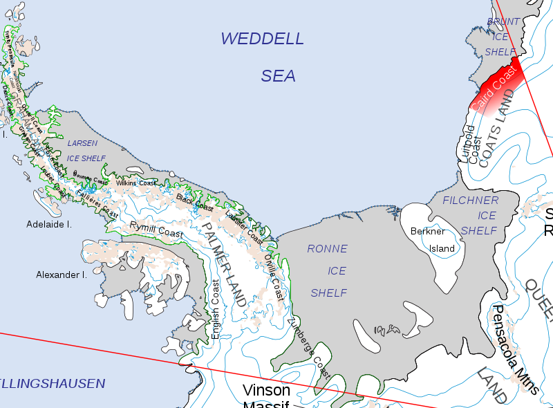
| Description | Location of the Caird Coast of Coats Land, in the British Antarctic Territory | ||
| Date | |||
| Source | Map of Queen Elizabeth Land, BAT.svg | ||
| Author | Hogweard | ||
| Permission (Reusing this file) |
|
File history
Click on a date/time to view the file as it appeared at that time.
| Date/Time | Thumbnail | Dimensions | User | Comment | |
|---|---|---|---|---|---|
| current | 23:41, 25 July 2020 | | 1,387 × 1,023 (4.52 MB) | Hogweard | Wider context |
File usage
The following file is a duplicate of this file (more details):
- File:Caird Coast.svg from a shared repository
The following page links to this file: