File:British isles 802.jpg
From Wikishire
Size of this preview: 572 × 599 pixels. Other resolution: 229 × 240 pixels.
Original file (1,076 × 1,127 pixels, file size: 1.29 MB, MIME type: image/jpeg)
Summary
| Description |
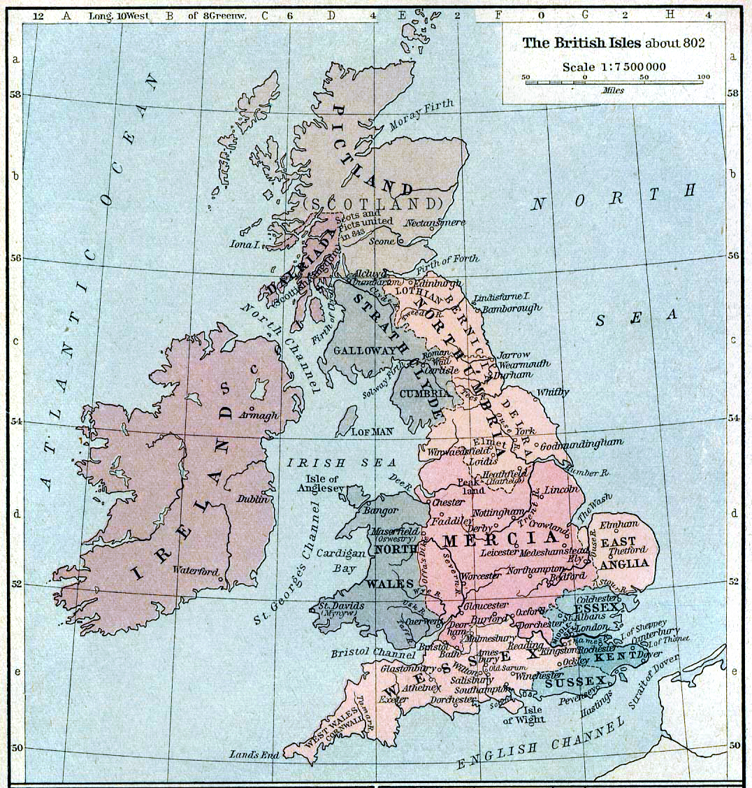
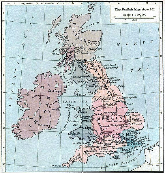
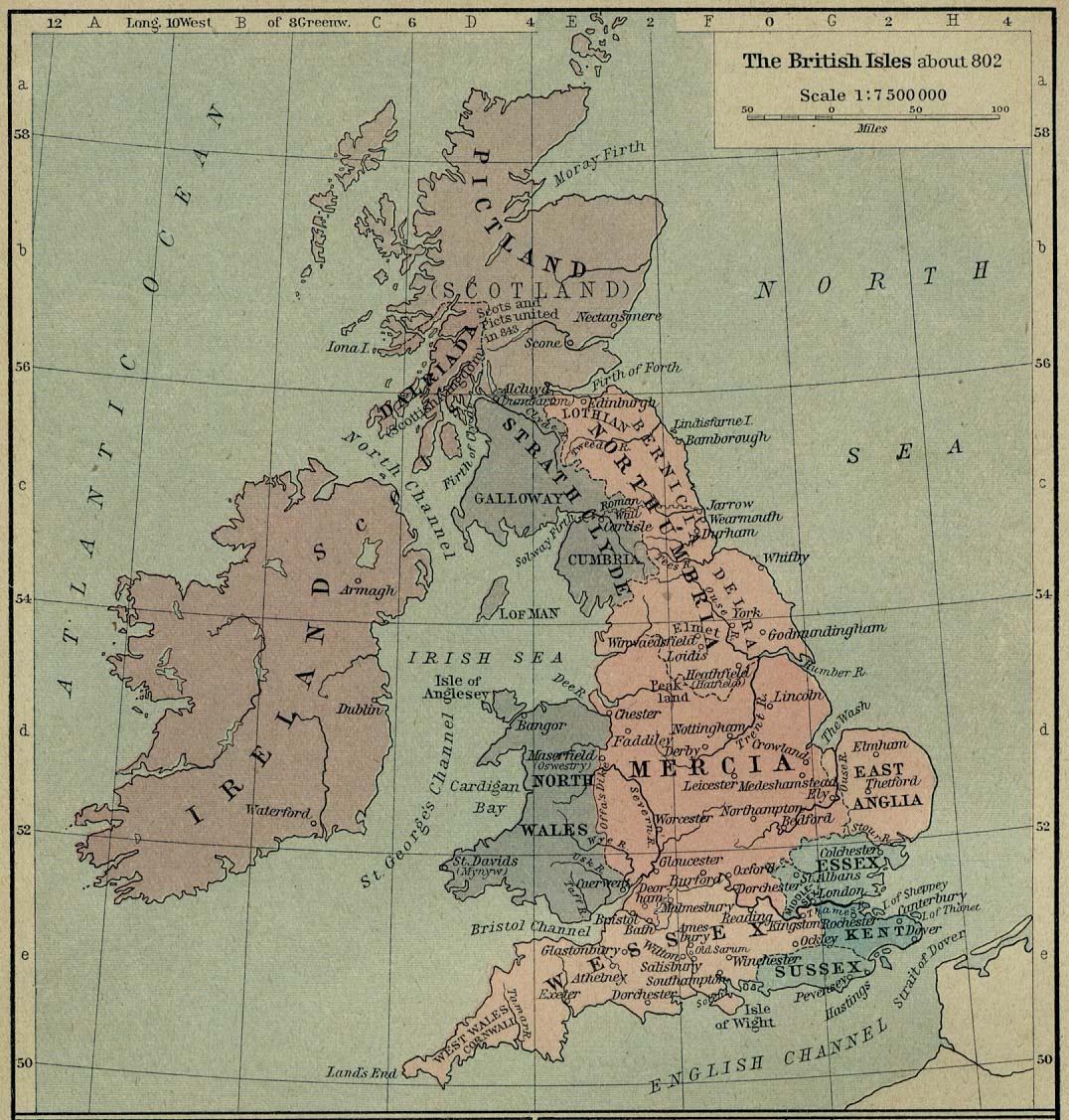
English: Map of the British Isles claiming to represent borders circa 802 AD. |
||||||||||||||||||||||
| Date | |||||||||||||||||||||||
| Source | Shepherd, William R. (1926) Historical Atlas, Category:New York: Henry Holt and Company | ||||||||||||||||||||||
| Author |
|
||||||||||||||||||||||
Licensing
|
The author died in 1934, so this work is in the public domain in its country of origin and other countries and areas where the copyright term is the author's life plus 80 years or fewer. This work is in the public domain in the United States because it was published (or registered with the U.S. Copyright Office) before January 1, 1929. | |
| This file has been identified as being free of known restrictions under copyright law, including all related and neighboring rights. | |
File history
Click on a date/time to view the file as it appeared at that time.
| Date/Time | Thumbnail | Dimensions | User | Comment | |
|---|---|---|---|---|---|
| current | 21:30, 12 August 2019 | | 1,076 × 1,127 (1.29 MB) | Alphathon | A few more minor tweaks |
File usage
The following file is a duplicate of this file (more details):
- File:British isles 802.jpg from a shared repository
The following page links to this file: