File:British Isles all.svg
From Wikishire

Size of this preview: 343 × 600 pixels. Other resolution: 137 × 240 pixels.
Original file (SVG file, nominally 675 × 1,180 pixels, file size: 54 KB)
Summary
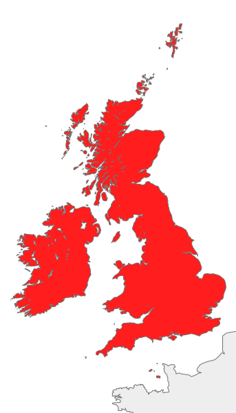
| Description | Map of Great Britain, Ireland, the Isle of Man and the Channel Islands, also known collectively as Islands of the North Atlantic |
| Date | |
| Source | Own work |
| Author | Cnbrb |
| Other versions | Derivative works of this file: British Isles Ireland higlighted.svg |
| SVG development |
Licensing
| I, the copyright holder of this work, release this work into the public domain. This applies worldwide. In some countries this may not be legally possible; if so: I grant anyone the right to use this work for any purpose, without any conditions, unless such conditions are required by law. |
File history
Click on a date/time to view the file as it appeared at that time.
| Date/Time | Thumbnail | Dimensions | User | Comment | |
|---|---|---|---|---|---|
| current | 23:30, 21 June 2018 | | 675 × 1,180 (54 KB) | Cnbrb | Reverted to version as of 08:21, 14 September 2012 (UTC) recolouring is inaccurate; Channel Islands are considered part of the British Isles |
File usage
The following file is a duplicate of this file (more details):
- File:British Isles all.svg from a shared repository
The following page links to this file: