File:Bridge over Six Mile Water, Antrim.jpg
From Wikishire
No higher resolution available.
Bridge_over_Six_Mile_Water,_Antrim.jpg (640 × 480 pixels, file size: 88 KB, MIME type: image/jpeg)
Summary
| Description |
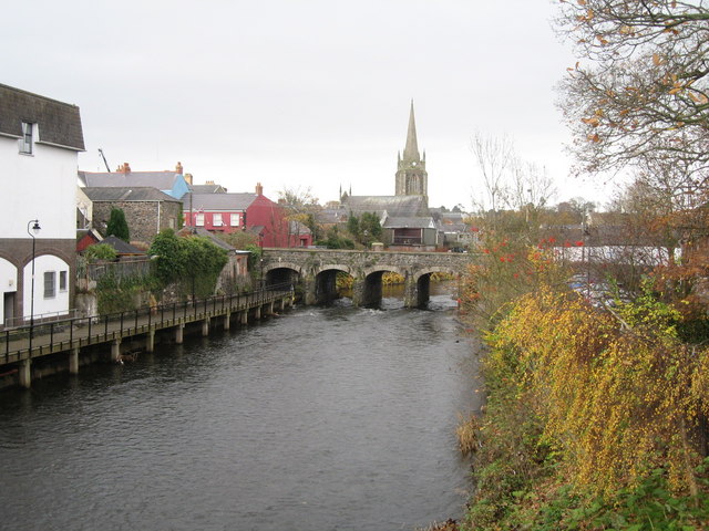
English: Bridge over Six Mile Water, Antrim Bridge Street bridge over Six Mile Water, Antrim. The octagonal spire of All Saints Church can be seen in the background, built in 1816, it is the most prominent feature of the Antrim skyline. |
| Date | |
| Source | From geograph.org.uk |
| Author | Sue Adair |
| Attribution (required by the license) | Sue Adair / Bridge over Six Mile Water, Antrim / |
| Camera location | | View this and other nearby images on: OpenStreetMap |
|---|
Licensing

|
This image was taken from the Geograph project collection. See this photograph's page on the Geograph website for the photographer's contact details. The copyright on this image is owned by Sue Adair and is licensed for reuse under the Creative Commons Attribution-ShareAlike 2.0 license.
|
This file is licensed under the Creative Commons Attribution-Share Alike 2.0 Generic license.
Attribution: Sue Adair
- You are free:
- to share – to copy, distribute and transmit the work
- to remix – to adapt the work
- Under the following conditions:
- attribution – You must give appropriate credit, provide a link to the license, and indicate if changes were made. You may do so in any reasonable manner, but not in any way that suggests the licensor endorses you or your use.
- share alike – If you remix, transform, or build upon the material, you must distribute your contributions under the same or compatible license as the original.
File history
Click on a date/time to view the file as it appeared at that time.
| Date/Time | Thumbnail | Dimensions | User | Comment | |
|---|---|---|---|---|---|
| current | 09:08, 13 February 2009 | | 640 × 480 (88 KB) | Прон | {{Information |Description={{bg|1=Изглед то Антрим с река Сикс Майл Уотър}} |Source=http://www.geograph.org.uk/photo/1116715 |Author=Sue Adair |Date=12 January, 2009 |Permission= |other_versions= }} <!--{{ImageUpload|full |
File usage
The following file is a duplicate of this file (more details):
- File:Bridge over Six Mile Water, Antrim.jpg from a shared repository
The following 3 pages link to this file: