File:Brentford Dock lock gates and Justin Close - geograph.org.uk - 1086302.jpg
From Wikishire
No higher resolution available.
Brentford_Dock_lock_gates_and_Justin_Close_-_geograph.org.uk_-_1086302.jpg (640 × 480 pixels, file size: 90 KB, MIME type: image/jpeg)
Summary
| Description |
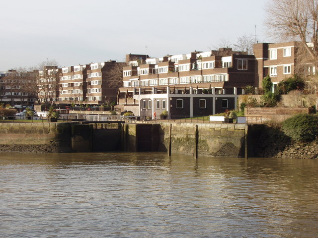
English: Brentford Dock has its single gate (a flood tide gate). It was once a major railway goods dock but today is a marina. It is a slightly smaller basin directly off the Thames, with slightly brutalist or simplistic but well-glazed mid-rise flats around it. |
| Date | |
| Source | From geograph.org.uk |
| Author | David Hawgood |
| Attribution (required by the license) | David Hawgood / Brentford Dock lock gates and Justin Close / |
| Camera location | | View this and other nearby images on: OpenStreetMap |
|---|
_heading:292.00&language=en)
| Object location | | View this and other nearby images on: OpenStreetMap |
|---|
_heading:292.00&language=en)
Licensing

|
This image was taken from the Geograph project collection. See this photograph's page on the Geograph website for the photographer's contact details. The copyright on this image is owned by David Hawgood and is licensed for reuse under the Creative Commons Attribution-ShareAlike 2.0 license.
|
This file is licensed under the Creative Commons Attribution-Share Alike 2.0 Generic license.
Attribution: David Hawgood
- You are free:
- to share – to copy, distribute and transmit the work
- to remix – to adapt the work
- Under the following conditions:
- attribution – You must give appropriate credit, provide a link to the license, and indicate if changes were made. You may do so in any reasonable manner, but not in any way that suggests the licensor endorses you or your use.
- share alike – If you remix, transform, or build upon the material, you must distribute your contributions under the same or compatible license as the original.
File history
Click on a date/time to view the file as it appeared at that time.
| Date/Time | Thumbnail | Dimensions | User | Comment | |
|---|---|---|---|---|---|
| current | 10:08, 24 February 2011 | | 640 × 480 (90 KB) | GeographBot | == {{int:filedesc}} == {{Information |description={{en|1=Brentford Dock lock gates and Justin Close Brentford Dock is a basin off the Thames, with modern housing around it.}} |date=2008-12-19 |source=From [http://www.geograph.org.uk/photo/1086302 geograph |
File usage
The following file is a duplicate of this file (more details):
- File:Brentford Dock lock gates and Justin Close - geograph.org.uk - 1086302.jpg from a shared repository
The following page links to this file: