File:Breach of manchester bolton and bury canal.jpg
From Wikishire
Size of this preview: 800 × 336 pixels. Other resolution: 320 × 134 pixels.
Original file (3,688 × 1,547 pixels, file size: 1.72 MB, MIME type: image/jpeg)
| Camera location | | View this and other nearby images on: OpenStreetMap |
|---|
Summary
| Description |
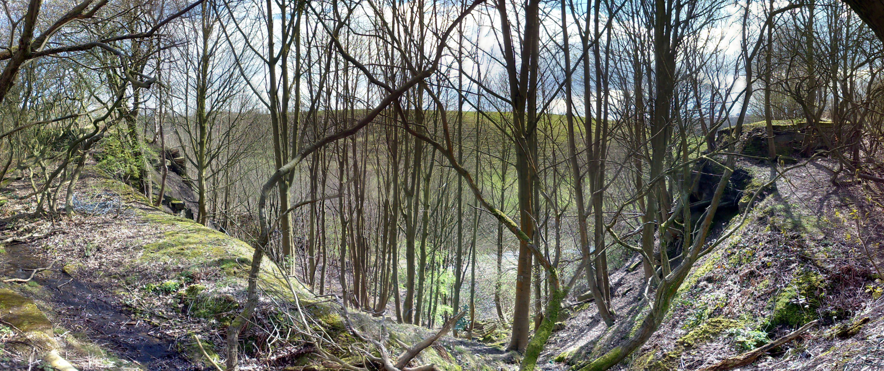
Author - Tom Jeffs. Taken 14/4/08 on my cameraphone, multiple images stitched together to give a wider shot. The 1936 breach above Prestolee Locks is shown here. The image is taken standing above the breach, the water would have flowed away from the camera, down the steep hill towards the river Irwell which is below the horizon. The significance of the breach is demonstrated by the remains of the towpath and canal walls, to the left and right of the image. Although not obvious from this image, there is still much debris from the breach on the hillside. The wide angle of the shot may be deceiving - the photographer is actually stood on the same level as the canal bed. The landslip between the broken walls is clearly visible. Prestolee locks, pictured below, are just to the right of and below this vantage. |
| Date | 28 July 2006 (original upload date) |
| Source | Transferred from en.wikipedia to Commons. |
| Author | Parrot of Doom at English Wikipedia |
Licensing
| This work has been released into the public domain by its author, Parrot of Doom at English Wikipedia. This applies worldwide. In some countries this may not be legally possible; if so: Parrot of Doom grants anyone the right to use this work for any purpose, without any conditions, unless such conditions are required by law. |
Original upload log
The original description page was here. All following user names refer to en.wikipedia.
- 2006-07-28 19:39 Parrot of Doom 2843×1160×8 (651775 bytes) Author - Tom Jeffs. Taken 28/7/06 on my cameraphone, multiple images stitched together to give a wider shot. The image shows the scale of the breach at Nob End locks. The left side of the image shows one side of the canal wall, the right side shows the
File history
Click on a date/time to view the file as it appeared at that time.
| Date/Time | Thumbnail | Dimensions | User | Comment | |
|---|---|---|---|---|---|
| current | 15:35, 15 April 2008 | | 3,688 × 1,547 (1.72 MB) | Parrot of Doom | Better higher resolution image with better light (fewer leaves!!) |
File usage
The following file is a duplicate of this file (more details):
- File:Breach of manchester bolton and bury canal.jpg from a shared repository
The following page links to this file: