File:Brandon railway station - the footbridge - geograph.org.uk - 1516141.jpg
From Wikishire
No higher resolution available.
Brandon_railway_station_-_the_footbridge_-_geograph.org.uk_-_1516141.jpg (640 × 485 pixels, file size: 101 KB, MIME type: image/jpeg)
Summary
| Description |
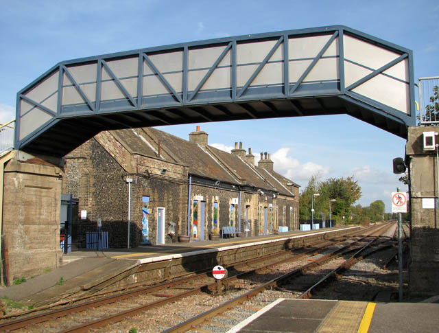
English: Brandon railway station - the footbridge A disk-type ground signal can be seen in the foreground. Brandon railway station serves the town of Brandon in Suffolk but the station is actually situated in Norfolk - on the other side of the county boundary. Before the re-introduction of a direct service between Cambridge and Norwich by Anglia Railways, Central Trains served the station as a stop on its route between Norwich and Liverpool, now operated by East Midlands Trains. Presently the station is managed by National Express East Anglia, with services east to Thetford, Attleborough, Wymondham and Norwich, and west to Ely and Cambridge. East Midlands Trains operates a single service to Norwich. The station has been un-staffed since the 1980s.
An initiative was launched in January 2006 by the Friends of Brandon Station aiming to improve the appearance and facilities, promote the fast and frequent services to Norwich, Ely and Cambridge, and to seek a new tenant for the station buildings |
| Date | |
| Source | From geograph.org.uk |
| Author | Evelyn Simak |
| Attribution (required by the license) | Evelyn Simak / Brandon railway station - the footbridge / |
| Camera location | | View this and other nearby images on: OpenStreetMap |
|---|
_heading:90.00&language=en)
| Object location | | View this and other nearby images on: OpenStreetMap |
|---|
_heading:90.00&language=en)
Licensing

|
This image was taken from the Geograph project collection. See this photograph's page on the Geograph website for the photographer's contact details. The copyright on this image is owned by Evelyn Simak and is licensed for reuse under the Creative Commons Attribution-ShareAlike 2.0 license.
|
This file is licensed under the Creative Commons Attribution-Share Alike 2.0 Generic license.
Attribution: Evelyn Simak
- You are free:
- to share – to copy, distribute and transmit the work
- to remix – to adapt the work
- Under the following conditions:
- attribution – You must give appropriate credit, provide a link to the license, and indicate if changes were made. You may do so in any reasonable manner, but not in any way that suggests the licensor endorses you or your use.
- share alike – If you remix, transform, or build upon the material, you must distribute your contributions under the same or compatible license as the original.
File history
Click on a date/time to view the file as it appeared at that time.
| Date/Time | Thumbnail | Dimensions | User | Comment | |
|---|---|---|---|---|---|
| current | 23:30, 2 March 2011 | | 640 × 485 (101 KB) | GeographBot | == {{int:filedesc}} == {{Information |description={{en|1=Brandon railway station - the footbridge A disk-type ground signal can be seen in the foreground. Brandon railway station serves the town of Brandon in Suffolk but the station is actually situated i |
File usage
The following file is a duplicate of this file (more details):
- File:Brandon railway station - the footbridge - geograph.org.uk - 1516141.jpg from a shared repository
The following page links to this file: