File:Botley Hill trig point - geograph.org.uk - 788400.jpg
From Wikishire

Size of this preview: 411 × 599 pixels. Other resolution: 164 × 240 pixels.
Original file (439 × 640 pixels, file size: 80 KB, MIME type: image/jpeg)
Summary
| Description |
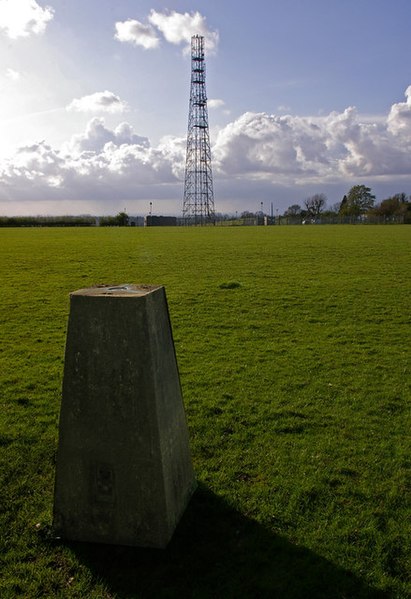
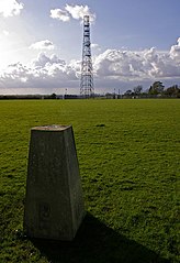
English: Botley Hill trig point. The highest trig point on the North Downs (benchmark at 266.88m), and until recently most references claimed that this also marked the highest point of the whole of the North Downs. However, in practice, this is not the case. Firstly the land seems to rise slightly to the east, and there is another area slightly to the west which also lies above the 265m contour, with the same 267m spot height (although older maps give the latter point a slightly lower height than the trig point when measured in feet). But more significantly, old 1 inch maps show a spot height of 882 feet next to the water tower in the next square over (see 788446), compared with only 877 feet at the trig point, implying that the true summit point of the North Downs could well be there.
This has since been confirmed by surveys. Unfortunately, views to the south at this point are blocked by the woodland of Titsey Plantation, and the nature of the plateau means that the expected view north over London is not available. Behind is one of a number of masts near Botley Hill, this one beside Botley Hill Farm. |
| Date | |
| Source | From geograph.org.uk |
| Author | Ian Capper |
| Attribution (required by the license) | Ian Capper / Botley Hill trig point / |
| Camera location | | View this and other nearby images on: OpenStreetMap |
|---|
_heading:315.00&language=en)
| Object location | | View this and other nearby images on: OpenStreetMap |
|---|
_heading:315.00&language=en)
Licensing

|
This image was taken from the Geograph project collection. See this photograph's page on the Geograph website for the photographer's contact details. The copyright on this image is owned by Ian Capper and is licensed for reuse under the Creative Commons Attribution-ShareAlike 2.0 license.
|
This file is licensed under the Creative Commons Attribution-Share Alike 2.0 Generic license.
Attribution: Ian Capper
- You are free:
- to share – to copy, distribute and transmit the work
- to remix – to adapt the work
- Under the following conditions:
- attribution – You must give appropriate credit, provide a link to the license, and indicate if changes were made. You may do so in any reasonable manner, but not in any way that suggests the licensor endorses you or your use.
- share alike – If you remix, transform, or build upon the material, you must distribute your contributions under the same or compatible license as the original.
File history
Click on a date/time to view the file as it appeared at that time.
| Date/Time | Thumbnail | Dimensions | User | Comment | |
|---|---|---|---|---|---|
| current | 00:47, 20 February 2011 | | 439 × 640 (80 KB) | GeographBot | == {{int:filedesc}} == {{Information |description={{en|1=Botley Hill trig point The highest trig point on the North Downs (benchmark at 266.88m), and until recently most references claimed that this also marked the highest point of the whole of the North |
File usage
The following file is a duplicate of this file (more details):
- File:Botley Hill trig point - geograph.org.uk - 788400.jpg from a shared repository
The following page links to this file: