File:Ashridge House - geograph.org.uk - 1568926.jpg
Summary
| Description |
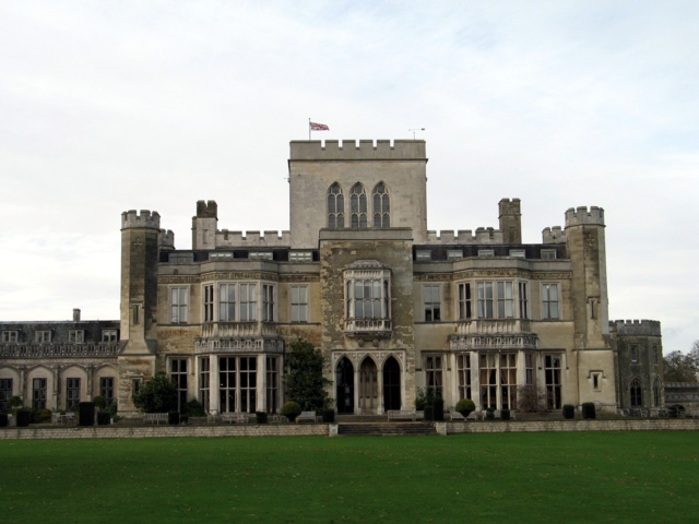
English: Ashridge House Ashridge House is one of the largest Gothic Revival country houses in England and is Grade I. listed. This view is of the rear of the House.
The House stands on the site of Ashridge Priory, a medieval abbey founded by the Brothers of Penitence. Following the Dissolution of the Monasteries, the building eventually became the private residence of Princess Elizabeth - later Elizabeth I. - and it was here that she was arrested in 1552 under suspicion of treason. In 1604 the priory was acquired by Sir Thomas Egerton. A descendant of his, the 3rd Duke of Bridgewater - he of canal-building fame - demolished the old buildings but did not live to see his plans for the House completed. His successor, the 7th Earl of Bridgewater, commissioned James Wyatt to build the present neo-gothic building as his home: it was completed in 1813. In 1921 the House was acquired by a trust established by Andrew Bonar Law, a former Prime Minister. In 1959 it became a management training college, and it continues in that role today with its own degree-awarding powers and an international reputation. |
| Date | |
| Source | From geograph.org.uk |
| Author | Ian Petticrew |
| Camera location | | View this and other nearby images on: OpenStreetMap |
|---|
_heading:315.00&language=en)
| Object location | | View this and other nearby images on: OpenStreetMap |
|---|
_heading:315.00&language=en)
Licensing

|
This image was taken from the Geograph project collection. See this photograph's page on the Geograph website for the photographer's contact details. The copyright on this image is owned by Ian Petticrew and is licensed for reuse under the Creative Commons Attribution-ShareAlike 2.0 license.
|
- You are free:
- to share – to copy, distribute and transmit the work
- to remix – to adapt the work
- Under the following conditions:
- attribution – You must give appropriate credit, provide a link to the license, and indicate if changes were made. You may do so in any reasonable manner, but not in any way that suggests the licensor endorses you or your use.
- share alike – If you remix, transform, or build upon the material, you must distribute your contributions under the same or compatible license as the original.
File history
Click on a date/time to view the file as it appeared at that time.
| Date/Time | Thumbnail | Dimensions | User | Comment | |
|---|---|---|---|---|---|
| current | 16:06, 3 March 2011 | | 640 × 480 (97 KB) | GeographBot | == {{int:filedesc}} == {{Information |description={{en|1=Ashridge House Ashridge House is one of the largest Gothic Revival country houses in England and is Grade I. listed. This view is of the rear of the House. The House stands on the site of Ashridg |
File usage
The following file is a duplicate of this file (more details):
- File:Ashridge House - geograph.org.uk - 1568926.jpg from a shared repository
The following page links to this file: