File:Anguilla map.png
From Wikishire
No higher resolution available.
Anguilla_map.png (325 × 349 pixels, file size: 6 KB, MIME type: image/png)
Summary
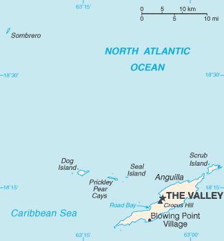
| Description |
Español: Mapa de Anguila
English: Map of British overseas territory of Anguilla, comprising main eponymous island and smaller islets and cays. |
|||
| Date | Unknown date | |||
| Source | CIA World Factbook | |||
| Author | United States Central Intelligence Agency | |||
| Permission (Reusing this file) |
|

File history
Click on a date/time to view the file as it appeared at that time.
| Date/Time | Thumbnail | Dimensions | User | Comment | |
|---|---|---|---|---|---|
| current | 22:44, 10 April 2023 | | 325 × 349 (6 KB) | Lojwe | Cropped 1 % horizontally, 1 % vertically using CropTool with precise mode. |
File usage
The following file is a duplicate of this file (more details):
- File:Anguilla map.png from a shared repository
The following page links to this file: