File:Alrewas Methodist Church, Staffordshire - geograph.org.uk - 1587845.jpg
From Wikishire
Size of this preview: 522 × 600 pixels. Other resolution: 209 × 240 pixels.
Original file (557 × 640 pixels, file size: 158 KB, MIME type: image/jpeg)
Summary
| Description |
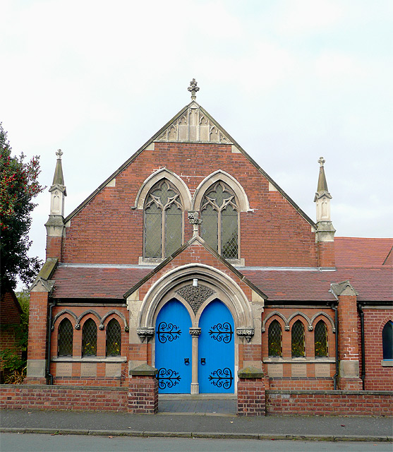
English: Methodist Church, Post Office Road, Alrewas, Staffordshire, built in 1928. When the Methodist Union took place in 1932, the Wesleyan and Primitive Churches in the village joined together for worship in the present building. In 1975 an extension was added to the schoolroom, providing new kitchen and toilet facilities. (Information from the church's own website). |
| Date | |
| Source | From geograph.org.uk |
| Author | Roger Kidd |
| Attribution (required by the license) | Roger Kidd / Alrewas Methodist Church, Staffordshire / |
| Camera location | | View this and other nearby images on: OpenStreetMap |
|---|
_heading:292.00&language=en)
| Object location | | View this and other nearby images on: OpenStreetMap |
|---|
_heading:292.00&language=en)
Licensing

|
This image was taken from the Geograph project collection. See this photograph's page on the Geograph website for the photographer's contact details. The copyright on this image is owned by Roger Kidd and is licensed for reuse under the Creative Commons Attribution-ShareAlike 2.0 license.
|
This file is licensed under the Creative Commons Attribution-Share Alike 2.0 Generic license.
Attribution: Roger Kidd
- You are free:
- to share – to copy, distribute and transmit the work
- to remix – to adapt the work
- Under the following conditions:
- attribution – You must give appropriate credit, provide a link to the license, and indicate if changes were made. You may do so in any reasonable manner, but not in any way that suggests the licensor endorses you or your use.
- share alike – If you remix, transform, or build upon the material, you must distribute your contributions under the same or compatible license as the original.
File history
Click on a date/time to view the file as it appeared at that time.
| Date/Time | Thumbnail | Dimensions | User | Comment | |
|---|---|---|---|---|---|
| current | 23:06, 3 March 2011 | | 557 × 640 (158 KB) | GeographBot | == {{int:filedesc}} == {{Information |description={{en|1=Alrewas Methodist Church, Staffordshire Built in 1928. When Methodist Union took place in 1932, the Wesleyan and Primitive Churches in the village joined together for worship in the present buil |
File usage
The following file is a duplicate of this file (more details):
- File:Alrewas Methodist Church, Staffordshire - geograph.org.uk - 1587845.jpg from a shared repository
The following page links to this file: