File:Allt yr Esgair - geograph.org.uk - 53496.jpg
From Wikishire
No higher resolution available.
Allt_yr_Esgair_-_geograph.org.uk_-_53496.jpg (640 × 402 pixels, file size: 53 KB, MIME type: image/jpeg)
Summary
| Description |
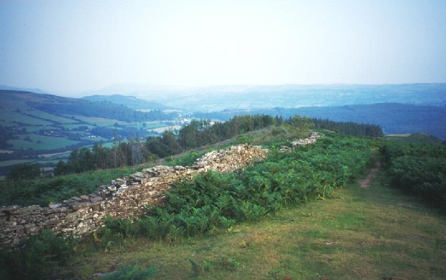
English: Allt yr Esgair. Near the summit of this elongated sandstone hill above Llangorse. A ruined stone wall encloses land later planted with conifers by the Forestry Commission. Looking southeast down the ridge. |
| Date | |
| Source | From geograph.org.uk |
| Author | Richard Webb |
| Attribution (required by the license) | Richard Webb / Allt yr Esgair / |
| Object location | | View this and other nearby images on: OpenStreetMap |
|---|
_&language=en)
Licensing

|
This image was taken from the Geograph project collection. See this photograph's page on the Geograph website for the photographer's contact details. The copyright on this image is owned by Richard Webb and is licensed for reuse under the Creative Commons Attribution-ShareAlike 2.0 license.
|
This file is licensed under the Creative Commons Attribution-Share Alike 2.0 Generic license.
Attribution: Richard Webb
- You are free:
- to share – to copy, distribute and transmit the work
- to remix – to adapt the work
- Under the following conditions:
- attribution – You must give appropriate credit, provide a link to the license, and indicate if changes were made. You may do so in any reasonable manner, but not in any way that suggests the licensor endorses you or your use.
- share alike – If you remix, transform, or build upon the material, you must distribute your contributions under the same or compatible license as the original.
- Remove redundant categories and try to put this image in the most specific category/categories
- Remove this template
- The location categories are based on information from this geonames tool and this OpenStreetMap tool combined with a database. You can also have a look at this tool from mysociety.
- The topic category from Geograph was Hill (find similar images at Geograph)
File history
Click on a date/time to view the file as it appeared at that time.
| Date/Time | Thumbnail | Dimensions | User | Comment | |
|---|---|---|---|---|---|
| current | 12:48, 30 January 2010 | | 640 × 402 (53 KB) | GeographBot | == {{int:filedesc}} == {{Information |description={{en|1=Allt yr Esgair. Near the summit of this elongated sandstone hill above Llangorse. A ruined stone wall encloses land later planted with conifers by the Forestry Commission. Looking southeast down the |
File usage
The following file is a duplicate of this file (more details):
- File:Allt yr Esgair - geograph.org.uk - 53496.jpg from a shared repository
The following page links to this file: