File:A38 between Burton and Derby - geograph.org.uk - 403009.jpg
From Wikishire
No higher resolution available.
A38_between_Burton_and_Derby_-_geograph.org.uk_-_403009.jpg (640 × 480 pixels, file size: 136 KB, MIME type: image/jpeg)
Summary
| Description |
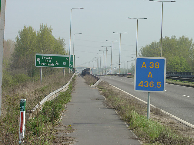
English: A38 between Burton and Derby This has been a major artery since Roman times and is now a heavily used dual carriageway Trunk Road. Here it also forms part of the Sustrans cycle network, which uses the footway/cycle path. |
| Date | |
| Source | From geograph.org.uk |
| Author | Alan Murray-Rust |
| Attribution (required by the license) | Alan Murray-Rust / A38 between Burton and Derby / |
| Camera location | | View this and other nearby images on: OpenStreetMap |
|---|
_heading:45.00&language=en)
| Object location | | View this and other nearby images on: OpenStreetMap |
|---|
_heading:45.00&language=en)
Licensing

|
This image was taken from the Geograph project collection. See this photograph's page on the Geograph website for the photographer's contact details. The copyright on this image is owned by Alan Murray-Rust and is licensed for reuse under the Creative Commons Attribution-ShareAlike 2.0 license.
|
This file is licensed under the Creative Commons Attribution-Share Alike 2.0 Generic license.
Attribution: Alan Murray-Rust
- You are free:
- to share – to copy, distribute and transmit the work
- to remix – to adapt the work
- Under the following conditions:
- attribution – You must give appropriate credit, provide a link to the license, and indicate if changes were made. You may do so in any reasonable manner, but not in any way that suggests the licensor endorses you or your use.
- share alike – If you remix, transform, or build upon the material, you must distribute your contributions under the same or compatible license as the original.
File history
Click on a date/time to view the file as it appeared at that time.
| Date/Time | Thumbnail | Dimensions | User | Comment | |
|---|---|---|---|---|---|
| current | 20:37, 3 February 2011 | | 640 × 480 (136 KB) | GeographBot | == {{int:filedesc}} == {{Information |description={{en|1=A38 between Burton and Derby This has been a major artery since Roman times and is now a heavily used dual carriageway Trunk Road. Here it also forms part of the Sustrans cycle network, which uses t |
File usage
The following file is a duplicate of this file (more details):
- File:A38 between Burton and Derby - geograph.org.uk - 403009.jpg from a shared repository
The following page links to this file: