Wyton, Huntingdonshire
From Wikishire
Revision as of 21:16, 23 April 2012 by RB (Talk | contribs) (Created page with '{{Infobox town |name=Wyton |county=Huntingdonshire |picture=Ouse Valley Way at Houghton - geograph.org.uk - 270668.jpg |picture caption=By the Ouse Valley Way |os grid ref=TL271…')
| Wyton | |
| Huntingdonshire | |
|---|---|
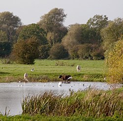
 By the Ouse Valley Way | |
| Location | |
| Grid reference: | TL271722 |
| Location: | 52°19’48"N, 0°7’48"W |
| Data | |
| Local Government | |
Wyton is a village in Huntingdonshire which is connected to the village of Houghton, so much so that the two settlements are rarely regarded as separate.
The village is about a mile south of RAF Wyton, which has the village's name.
Wyton sits on the lush, green banks of the Great Ouse. The river is an attractive feature of the village and there are several walks along its banks, and watching boats passing through the lock is a popular summer pastime.
Wyton's parish church Wyton closed, declared redundant in 1974, and is now a private house. The church was dedicated to St Margaret and All Saints; it is of mainly 13th to 14th Century work but was extensively restored in 1841-1867.
This Huntingdonshire article is a stub: help to improve Wikishire by building it up.