Difference between revisions of "Woodford"
From Wikishire
| Line 4: | Line 4: | ||
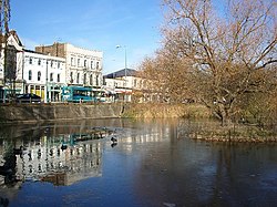
|picture=Frosty_morning,_Woodford_Green_-_geograph.org.uk_-_92356.jpg | |picture=Frosty_morning,_Woodford_Green_-_geograph.org.uk_-_92356.jpg | ||
|picture caption=Woodford green | |picture caption=Woodford green | ||
| − | |post town=London | + | |post town=London / Woodford Green |
|postcode=E18, IG8 | |postcode=E18, IG8 | ||
|dialling code=020 | |dialling code=020 | ||
Revision as of 22:07, 6 September 2013
| Woodford | |
| Essex | |
|---|---|
 Woodford green | |
| Location | |
| Grid reference: | TQ405915 |
| Location: | 51°36’17"N, 0°1’47"E |
| Data | |
| Post town: | London / Woodford Green |
| Postcode: | E18, IG8 |
| Dialling code: | 020 |
| Local Government | |
| Council: | Redbridge |
| Parliamentary constituency: |
Ilford North / Leyton and Wanstead |
Woodford is a suburban town in southwest Essex, within the greater London conurbation. It is contiguous with Snaresbrook and Wanstead to the south, Walthamstow and Chingford to the west and Hainault to the east.
This Essex article is a stub: help to improve Wikishire by building it up.