Woodchester
| Woodchester | |
| Gloucestershire | |
|---|---|
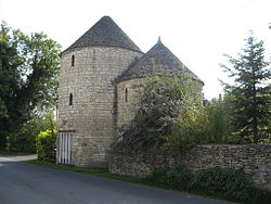
 Double Round House at Woodchester | |
| Location | |
| Grid reference: | SO840027 |
| Location: | 51°43’23"N, 2°13’54"W |
| Data | |
| Post town: | Stroud |
| Postcode: | GL5 |
| Local Government | |
| Council: | Stroud |
| Parliamentary constituency: |
Stroud |
Woodchester is a Gloucestershire village in the Nailsworth (or Woodchester) Valley, a valley in the southern Cotswolds running southwards from Stroud along the A46 road to Nailsworth. The parish population taken at the 2011 census was 1,206.
Woodchester stand beside the A46 road, about hlfway between Stroud (two miles to the north) and Nailsworth. It is divided into North and South Woodchester, with a side valley between the two settlements. There are pubs in both North and South (The Royal Oak in North and The Ram in South) and a post office with a shop in North Woodchester. There was a post office (called Woodchester) in South Woodchester but it closed, along with the shop, in June 2008.
About the village
Woodchester is notable as the location of Woodchester Roman Villa.[1]
The village's parish church of St Mary's was designed by Samuel Sanders Teulon.
The nearby Woodchester Mansion is regularly open to the public and stands in a landscaped valley. This valley is now owned by the National Trust and is open daily.
There are three waymarked walks around the parish amongst the Cotswold Hills.
The former Convent of Poor Clares was home to nuns of the Poor Clares order from 1850 to 2011.[2]
Outside links
| ("Wikimedia Commons" has material about Woodchester) |
References
- ↑ Graham Thomas (2000) The Romans at Woodchester Orpheus Mosaic at Woodchester
- ↑ "Convent will close its doors after 150th anniversary". Stoud News and Journal. 21 April 2011. http://www.stroudnewsandjournal.co.uk/news/8989075.Convent_will_close_its_doors_after_150th_anniversary/.