Difference between revisions of "Winshill"
m (→History) |
|||
| Line 25: | Line 25: | ||
The name Winshill has its origin in Old English and means Wine's hill.<ref>Place-Names of Derbyshire iii (E.P.N.S. xxix), 669.</ref> There was a settlement here in the late 11th century when William I installed privileged tenants at Winshill. By this time there was a corn mill on the Winshill bank of the [[River Trent]], and in the 14th century a fulling mill – which became a cotton mill in the late 18th century - was built on an island nearby. By the end of the 18th century the village was grouped around a green on the east side of the hill. The mediæval Burton bridge crossed into Winshill at its east end, and the road to [[Ashby-de-la-Zouch]] then followed a line along Bearwood Hill Road and High Bank Road. A tollgate was placed near the foot of Bearwood Hill Road when it became a turnpike road in 1753. The Ashby Road was put onto a more direct line in the later 1830s and the tollgate was placed near Moat Bank. | The name Winshill has its origin in Old English and means Wine's hill.<ref>Place-Names of Derbyshire iii (E.P.N.S. xxix), 669.</ref> There was a settlement here in the late 11th century when William I installed privileged tenants at Winshill. By this time there was a corn mill on the Winshill bank of the [[River Trent]], and in the 14th century a fulling mill – which became a cotton mill in the late 18th century - was built on an island nearby. By the end of the 18th century the village was grouped around a green on the east side of the hill. The mediæval Burton bridge crossed into Winshill at its east end, and the road to [[Ashby-de-la-Zouch]] then followed a line along Bearwood Hill Road and High Bank Road. A tollgate was placed near the foot of Bearwood Hill Road when it became a turnpike road in 1753. The Ashby Road was put onto a more direct line in the later 1830s and the tollgate was placed near Moat Bank. | ||
| − | Winshill was popular in the 19th century with prosperous citizens of Burton who built large houses like Bladon House, The Woodlands, Highfield House and Moat Bank on the higher ground overlooking the town. At the same time rows of houses were being built for brewery workers on Bearwood Hill, Ashby Road and Alexandra Road. A school was opened at the north end of the village in 1846, and a Methodist chapel opened in 1845. The church of St Mark's was built in 1868, on a prominent site on the top of the hill overlooking the developing village.<ref>[http://www.british-history.ac.uk/report.asp?compid=12371 British History Online ''Winshill: Introduction.'' A History of the County of | + | Winshill was popular in the 19th century with prosperous citizens of Burton who built large houses like Bladon House, The Woodlands, Highfield House and Moat Bank on the higher ground overlooking the town. At the same time rows of houses were being built for brewery workers on Bearwood Hill, Ashby Road and Alexandra Road. A school was opened at the north end of the village in 1846, and a Methodist chapel opened in 1845. The church of St Mark's was built in 1868, on a prominent site on the top of the hill overlooking the developing village.<ref>[http://www.british-history.ac.uk/report.asp?compid=12371 British History Online ''Winshill: Introduction.'' A History of the County of Stafford: Volume IX, Nigel J. Tringham (Editor) (2003)]</ref> |
In 1921 the Board of Education purchased "The Woodlands" property to provide a new campus for Burton Girls High School. This became incorporated into the comprehensive Abbot Beyne School in 1975. | In 1921 the Board of Education purchased "The Woodlands" property to provide a new campus for Burton Girls High School. This became incorporated into the comprehensive Abbot Beyne School in 1975. | ||
Latest revision as of 18:28, 24 November 2020
| Winshill | |
| Derbyshire | |
|---|---|
 Waterloo Clump - Winshill Water Tower | |
| Location | |
| Grid reference: | SK267234 |
| Location: | 52°50’6"N, 1°37’16"W |
| Data | |
| Population: | 8,466 (2011[1]) |
| Post town: | Burton on Trent |
| Postcode: | DE15 |
| Dialling code: | 01283 |
| Local Government | |
| Council: | East Staffordshire |
| Parliamentary constituency: |
Burton |
Winshill is a civil parish in Derbyshire that forms a suburb of Burton upon Trent, in neighbouring Staffordshire. The civil parish corresponds to the township of Winshill in the ancient parish of Burton on Trent.
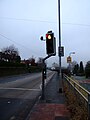
Along its southern flank runs the A511 road, known locally as the Ashby Road, from Bretby Lane and Moat Bank (Burton upon Trent's highest point) to the eastern end of the Trent Bridge and the junction with the A444.
Along its western flank are the River Trent and the B5008 Newton Road, which runs to Newton Solney and Repton.
The parish church in Winshill is St Mark's, part of the Diocese of Derby.
History
The name Winshill has its origin in Old English and means Wine's hill.[2] There was a settlement here in the late 11th century when William I installed privileged tenants at Winshill. By this time there was a corn mill on the Winshill bank of the River Trent, and in the 14th century a fulling mill – which became a cotton mill in the late 18th century - was built on an island nearby. By the end of the 18th century the village was grouped around a green on the east side of the hill. The mediæval Burton bridge crossed into Winshill at its east end, and the road to Ashby-de-la-Zouch then followed a line along Bearwood Hill Road and High Bank Road. A tollgate was placed near the foot of Bearwood Hill Road when it became a turnpike road in 1753. The Ashby Road was put onto a more direct line in the later 1830s and the tollgate was placed near Moat Bank.
Winshill was popular in the 19th century with prosperous citizens of Burton who built large houses like Bladon House, The Woodlands, Highfield House and Moat Bank on the higher ground overlooking the town. At the same time rows of houses were being built for brewery workers on Bearwood Hill, Ashby Road and Alexandra Road. A school was opened at the north end of the village in 1846, and a Methodist chapel opened in 1845. The church of St Mark's was built in 1868, on a prominent site on the top of the hill overlooking the developing village.[3]
In 1921 the Board of Education purchased "The Woodlands" property to provide a new campus for Burton Girls High School. This became incorporated into the comprehensive Abbot Beyne School in 1975.
Commerce
Pubs in Winshill include:
- The Anglesey
- The Jubilee
- The Nelson (closed)
- The Sump
- The Swan (closed and refurbished as flats and car park built on in 2014)
- The Traveller's Rest (closed and demolished April 2008), and
- The Waterloo.
People from Winshill
- Sir Francis Ley who founded Baseball in Derby (and a large foundry) was born here in 1846.
- First World War hero William Harold Coltman VC, DCM and Bar, MM and Bar, is buried in the graveyard of the Winshill parish church of St Mark's.
References
- ↑ "Civil Parish population 2011". http://www.neighbourhood.statistics.gov.uk/dissemination/LeadKeyFigures.do?a=7&b=11130750&c=winshill&d=16&e=62&g=6463437&i=1001x1003x1032x1004&m=0&r=1&s=1450018523036&enc=1. Retrieved 13 December 2015.
- ↑ Place-Names of Derbyshire iii (E.P.N.S. xxix), 669.
- ↑ British History Online Winshill: Introduction. A History of the County of Stafford: Volume IX, Nigel J. Tringham (Editor) (2003)
Gallery

St Marks parish church
A511 Ashby Road - looking west downhill towards Burton upon Trent
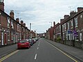
Bearwood Hill Road - major thoroughfare into the centre of Winshill


Outside links
| ("Wikimedia Commons" has material about Winshill) |