Wikishire:Map
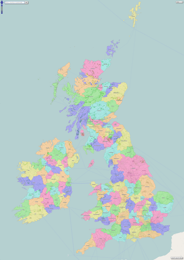
Wikishire's mapping service is available at https://wikishire.co.uk/map/. It allows Great Britain and Ireland to be explored and a range of useful data presented right on the map itself.
Contents
The map can be scrolled in a number of ways: using the arrow buttons in the top-left of the screen, by means of the cursor keys, or clicking-and-dragging with the mouse for desktop users. Touchscreen users can drag a finger on the screen to re-centre the map. Zooming in and out can be performed by means of the zoom slider in the top-left of the screen or the mouse's scroll wheel for desktop users. Touchscreen users can use the usual pinch-to-zoom gesture.
Search
The search box at the top-left of the screen allows a range of data to be presented on the map. A user can enter a place name, a county name, a postcode, a map grid reference or latitude/longitude pair.
Gazetteer
If a place name is entered it will be searched in the gazetteer. If it is a unique place name in Britain and Ireland then a pin will be placed on the map to indicate the place, with a pop-up cloud to label it; for example Newcastle-upon-Tyne. If the name is not unique the user will be presented with a choice of place names listed along with the relevant county and co-ordinates to aid selection, for example Newport.
County lookup
If a county name is entered the map will zoom to that county and place a pin in the geographical centre. A cloud pop-up will then display information about the county; for example: Huntingdonshire.
Postcode lookup
If a postcode is entered then a pin will be placed on the map to indicate the place, with a pop-up cloud to label into which county the postcode falls. For example: SW1A 1AA This also works for the postcode district only; for example: B4
Geolocation
A 'locate' button in the bottom-right of the screen allows the user to place a pin on the map at their current location, assuming that place is in Great Britain or Ireland! This is especially useful for mobile users who can determine in which county they are currently situated.
Layers
The map can have a number of layers overlaid onto it to show different features, by means of the 'layer' button in the bottom-right of the screen. The features are:
The National Trust layer contains information on National Trust, National Trust for Scotland and An Taisce properties.
Be warned that there are so many forests, hills and water features that the map must be suitably zoomed to be able to see any of the map underneath thousands of pins!
Backgrounds
The map background itself defaults to the standard colour map of counties. There are four choices which can be selected using the menu in the top-right of the screen:
- Colour: The counties identified in colour.
- Outline: The counties outlined in purple.
- Colour Det: The counties, with detached parts identified in colour.
- Outline Det: The counties, with detached parts, outlined in purple.
Map widgets
To incorporate inset maps on your own pages, use the following code:
<script src="https://wikishire.co.uk/map/inset"></script>
<div id="map"></div>
The inset code can be passed parameters to configure aspects of the map as follows:
- To change the base layer, use base=name, where name is one of colour, outline, colour_detached or outline_detached.
- To change the name of the DIV in which the map is drawn, use id=something, e.g. https://wikishire.co.uk/map/inset?id=something, draws into <div id="something">
- To specify the centre of the map, use centre=lon,lat
- To specify the zoom level of the map, use zoom=zoomlevel
The map can be controlled using the standard OpenLayers functions, where the map object is of the form id_map. This allows multiple maps on the same page to be controlled independently. For instance, if you use https://wikishire.co.uk/map/inset?id=colour and https://wikishire.co.uk/map/inset?id=outline&base=outline, two OpenLayers objects are created, colour_map, and outline_map.
