Whalers Bay
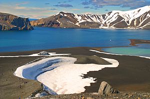
Whalers Bay is a small bay on the coast of Deception Island in the South Shetland Islands, part of the British Antarctic Territory. It is entered between Fildes Point and Penfold Point on north side of Neptunes Bellows, and at the east side of Port Foster.
The bay was known to nineteenth-century sealers probably by the name Deception Harbour, though this name may have been used refer to the whole of Port Foster, The name 'Whalers' Cove' was given by the French Antarctic Expedition of 1908-10, under Charcot, because of its use at that time by Norwegian whalers.
History
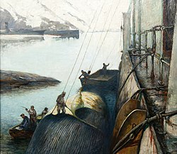
Port Foster being the best harbour in the South Shetland Islands, and indeed in the Antarctic, it attracted whaling ships in the great days of that trade. It is reported that Norwegian whalers in 1909 named the bay 'New Sandefiord' after their home port. It was at this time that Charcot's expedition arrived, and gave it the name Anse des Baleiniers; 'Whalers' Cove'.
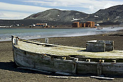
In the 1912-13 season, the Hektor Whaling Company of Norway erected a factory on the shire of Whalers Bay under licence from the Falkland Islands Dependencies Government license, the first whale being processed on 24 December 1912. The factory continued in operation each season until 1931. Remains of the whaling station, named 'Hektor' still stand on the shore of the bay, though the factory was destroyed by a volcanic eruption.
The headquarters for a British Magistrate was established on the bay in 1909 and was occupied continuously by magistrates until 1931.
Geological work was carried out in the vicinity of the bay by the Norwegian Antarctic Expedition of 1927-28. In the 1928-29 season, between November and January, Sir Hubert Wilkins established a base here for flying operations with a ski-equipped Lockheed Vega monoplane, the flight of 16 November being the first ever made in Antarctica.
The bay was further charted by Discovery Investigations in 1934-35.
The Falkland Islands Dependencies Survey station, called "Base B" or "Deception Island", was established on the bay on 6 February 1944; it was destroyed by fire in September 1946, rebuilt in the 1946-47 season, and continuously occupied until 5 December 1967, when it was closed down following a volcanic eruption. The bay was recharted by a Royal Navy Hydrographic Survey Unit, 1948-49.
An Argentine hut was constructed on the bay, 14 January 1953, and called "Teniente Cándido de la Sala" after an officer of the Argentine Marines who died on active service; the hut was dismantled by the Falkland Islands Dependencies Survey on 15 February 1953. A Chilean refuge hut was also constructed on the bay in January 1953 and dismantled by the Falkland Islands Dependencies Survey.
The bay was used as a base for flying operations by the Falkland Islands and Dependencies Aerial Survey Expedition of 1956-57. The British station was used as a base for the British Antarctic Survey air operations between 4 December 1968 and 23 February 1969, when further volcanic activity severely damaged the British station and totally destroyed the old whaling factory.
Historic site
The site has been designated a Historic Site or Monument (HSM 71), following a proposal by Chile and Norway to the Antarctic Treaty Consultative Meeting.
The designated site comprises all pre-1970 remains on the shore of the bay. These include artefacts and structural remains from the early whaling period (1906–1912) associated with Captain Adolfus Andresen of the Chilean Sociedad Ballenera de Magallanes, the Norwegian Hektor Whaling Station (1912–1931), the period of British scientific and mapping activity (1944–1969), and a cemetery containing 35 burials and a memorial to ten men lost at sea. It also commemorates and acknowledges the historic value of other events that occurred there.[1]
Location map
- Location map: 62°58’60"S, 60°33’42"W
| ("Wikimedia Commons" has material about Whalers Bay) |
References
- ↑ "List of Historic Sites and Monuments approved by the ATCM (2012)". Antarctic Treaty Secretariat. 2012. http://www.ats.aq/documents/ATCM35/WW/atcm35_ww003_e.pdf. Retrieved 2014-01-05.
- Gazetteer and Map of The British Antarctic Territory: Whalers Bay


