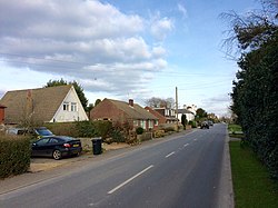
Union Street
From Wikishire
| Union Street | |
| Sussex | |
|---|---|
 Union Street, Sussex | |
| Location | |
| Grid reference: | TQ707311 |
| Location: | 51°3’16"N, 0°26’8"E |
| Data | |
| Postcode: | TN5 |
| Local Government | |
| Council: | Rother |
| Parliamentary constituency: |
Bexhill and Battle |
Union Street is a hamlet in Sussex, in the west of the county, close by the border of Kent, just a quarter of a mile to the north.
The hamlet lies along on the B2087 from Ticehurst, a mile and a half to the south-west, and runs into Flimwell, a Sussex village barely bigger, to the east, where the parish church and the local pub are found.