Turnditch
From Wikishire
Revision as of 22:53, 19 June 2021 by RB (Talk | contribs) (Created page with "{{Infobox town |name=Turnditch |county=Derbyshire |picture=Turnditch. - geograph.org.uk - 177283.jpg |picture caption=School at Turnditch. |os grid ref=SK293463 |latitude=53.0...")
| Turnditch | |
| Derbyshire | |
|---|---|
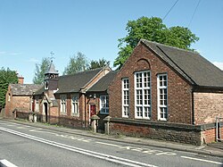
 School at Turnditch. | |
| Location | |
| Grid reference: | SK293463 |
| Location: | 53°-0’50"N, 1°33’50"W |
| Data | |
| Population: | 301 (2011) |
| Post town: | Belper |
| Postcode: | DE56 |
| Dialling code: | 01773 |
| Local Government | |
| Council: | Amber Valley |
| Parliamentary constituency: |
Amber Valley |
Turnditch is a village in Derbyshire, around ten miles north of Derby on the A517 road from Belper to Ashbourne. A modest place, the population of the civil parish at the 2011 Census was 301.
The village is built on both sides of the road halfway up the steep climb out of the Ecclesbourne Valley. Nearer to the brow of the hill is a place known as Cross o' th' Hands.
In Norman times the village was within Duffield Frith and part of the manor of Duffield.
The Church of All Saints was built in the 13th century as a chapel of ease to Duffield, while a Congregational chapel with a Sunday school was erected in 1818.[1][2]
Outside links
| ("Wikimedia Commons" has material about Turnditch) |
References
- ↑ Daniel and Samuel Lysons: Magna Britannia, volume 5, pages 129-142: 'Parishes: Doveridge - Duffield' (1817)
- ↑ http://www.andrewspages.dial.pipex.com/dby/kelly/turnditch.htm Kelly's Directory of the Counties of Derby, Notts, Leicester and Rutland pub. London (May, 1891) - p.321