Thorpe, Nottinghamshire
From Wikishire
| Thorpe | |
| Nottinghamshire | |
|---|---|

| |
| Location | |
| Grid reference: | SK764499 |
| Location: | 53°2’28"N, 0°51’41"W |
| Data | |
| Post town: | Newark |
| Postcode: | NG23 |
| Dialling code: | 01636 |
| Local Government | |
| Council: | Newark and Sherwood |
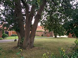
Thorpe, otherwise known as Thorpe by Newark is a tiny Nottinghamshire village standing to the east of East Stoke about a mile off the A46 Fosse Way, in the countryside south-west of Newark-on-Trent.
The parish church is St Laurence's.
Historical
White's Directory of Nottinghamshire in 1853 reported:
Thorpe-by-Newark is a village three miles to the south-west of Newark, with a population of 108 inhabitants and 697 acres of land of the rateable value of £1,419. About 180 acres of common land was enclosed 40 years ago, and exonerated from tithes, but all the rest still remains titheable. Sir Robert Howe Bromley, Bart., is principal owner, and lord of the manor...W.R. Brockton Esq. is a small owner, and Mr John Tomlin is a resident owner, with a few other small owners."[1]
The Roman fort known as Ad Pontem is located east of the Fosse Way Roman road north-east of the village.
In 1848, Samuel Lewis reported:
The church exhibits portions in the several styles of English architecture; the tower was formerly surmounted with a steeple. A fine tessellated pavement, some coins, and other Roman relics, have been discovered. On a small mound in a field adjoining the turnpike-road Henry VII is said to have erected his standard, on 6 June 1487, the day upon which he fought the battle of Stoke Field with the Earl of Lincoln."[2]
Outside links
| ("Wikimedia Commons" has material about Thorpe, Nottinghamshire) |
References
- ↑ Information on Thorpe, Nottinghamshire from GENUKI: White's Directory of Nottinghamshire 1853
- ↑ Lewis, Samuel: 'A Topographical Dictionary of England' (S. Lewis and Co., 1848) ISBN 978-0-8063-1508-9: Thornville – Thorpe