Teesdale
Teesdale is the dale of the River Tees as it slices down through the east side of the Pennines, and all the way from the watershed to the sea it marks the border between Yorkshire to the south and County Durham to the north.
Large parts of Teesdale fall within the 'North Pennines Area of Outstanding Natural Beauty'.
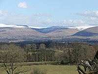
The River Tees rises below Cross Fell, the highest hill in the Pennines (at 2,930 feet above sea level), and its uppermost valley is remote and high. The local climate was scientifically classified as "Sub-Arctic" and snow has sometimes lain on Cross Fell into June (there is an alpine ski area Yad Moss). [1][2]
Geology
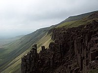
Unusually for the Pennines, rock of igneous origin, the Whin Sill contributes to the surface geology and scenery of Teesdale. Around 295 million years ago upwelling magma spread through fissures and between strata in the earlier Carboniferous Limestone country rock.
More recently, Ice Age glacial activity shaped the valley, and much of the pre-glacial river course is now buried beneath glacial drift.
Botany
In places this impervious dolerite rock, with shallow soil above it, prevented the growth of scrub or trees: this enabled certain post-glacial Arctic / Alpine plants to survive here when elsewhere as a rule they were overgrown. The sugar limestone formed by thermal metamorphism of the limestone into which the Whin Sill was intruded also meets the requirements of some of these plants. Teesdale is famous among naturalists for the "Teesdale Assemblage" of plants found together here that occur widely separated in other locations, abroad or in the British Isles.
Part of Upper Teesdale near the Cow Green Reservoir is designated a National Nature Reserve; it contains the unique Teesdale Violet and the blue Spring Gentian as well as more common Pennine flowers such as rockrose, spring sandwort, mountain pansy, bird's-eye primrose and butterwort]]. Hay meadows in the valley above High Force, some now carefully cultivated to ensure this, contain an extremely rich variety of flowering plants including globe flower, wood cranesbill and Early Purple Orchid. On the south bank of the Tees near High Force can be seen the largest surviving juniper wood in these counties.
Geography and history
Teesdale's principal town and most populous settlement is Barnard Castle in County Durham, a historic market town that is home to the renowned Bowes Museum.
In South Teesdale, which is the northernmost part of the North Riding of Yorkshire, are several fine villages including Mickleton Romaldkirk and Cotherstone. Here too is the Bronze Age burial site of Kirkcarrion.
Over in County Durham, Middleton-in-Teesdale was a lead-mining centre, and plentiful traces of this industry can be seen round the adjoining slopes and side-valleys. Other noteworthy Durham villages in Tessdale include Eggleston.
Over ledges in the Whin Sill fall the famous waterfalls of High Force and Low Force and the cataract of Cauldron Snout, over each of which pours the River Tees.
The River Tees flows through Teesdale before reaching and passing between Barnard Castle and Startforth, thereafter passing to the south of Darlington, reaching the North Sea south of Hartlepool after passing Stockton-on-Tees and Middlesbrough.
Running roughly parallel to Teesdale to the north is Weardale.
Outside links
- Teesdale Gateway
- Bowes Museum, Barnard Castle
- Teesdale District Council
- Explore Teesdale
- Radio Teesdale
- Middleton Plus
- North Pennines Area of Outstanding Natural Beauty (AONB) and European Geopark
- Yad Moss Ski Area

