Stretton, Derbyshire
From Wikishire
| Stretton | |
| Derbyshire | |
|---|---|
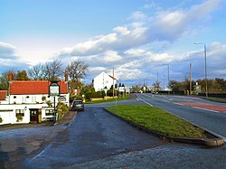
 White Bear intersection. | |
| Location | |
| Grid reference: | SK392612 |
| Location: | 53°8’49"N, 1°24’54"W |
| Data | |
| Population: | 525 (2011) |
| Post town: | Alfreton |
| Postcode: | DE55 |
| Local Government | |
| Council: | North East Derbyshire |
Stretton is a small village in Derbyshire, in the east of the county near Clay Cross and three and a half miles from Alfreton on the A61. The nearest streams are the River Amber and Smithy Brook. The village is narrow, stretched south to north along just one road, the A61, which follows the route of Ryknild Street, a Roman road. This road gives the village its name, stræt tun, meaning "street-village'.
Since 1964, Stretton has been beside Ogston Reservoir which still has the remains of a pub (Napoleon's Home) and a light railway within its depths.[1]
The parish includes the settlement of Woolley Moor, and the population of this parish as at the 2011 Census was 525.
There was once a railway station here: Stretton Station.
Outside links
| ("Wikimedia Commons" has material about Stretton, Derbyshire) |
- Stretton on DerbyshireUK