St Nicholas
From Wikishire
| St Nicholas | |
| Glamorgan | |
|---|---|

| |
| Location | |
| Location: | 51°27’38"N, 3°26’24"W |
| Data | |
| Post town: | Cardiff |
| Postcode: | CF5 |
| Dialling code: | 01446 |
| Local Government | |
| Council: | Vale of Glamorgan |
| Parliamentary constituency: |
Vale of Glamorgan |
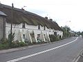
St Nicholas is a small village and ancient parish in Glamorgan, located seven miles west of Cardiff.
Amenities & History
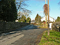
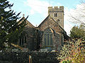
The A48 road divides the village in half, with a parish church and primary school north of it and housing south of it. However there are no shops or pubs in the village, the nearest being in Bonvilston or Culverhouse Cross. The A4226 (Five Mile Lane) connects it to nearby Barry from the A48.
It is served by public transport by bus services westbound to Bonvilston, Cowbridge, Bridgend and Porthcawl, and eastbound to Culverhouse Cross, Ely, Canton and Cardiff Central bus station.
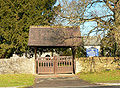
Gallery
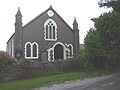
Presbyterian church
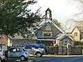
Primary school
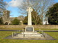
Memorial


Outside links
| ("Wikimedia Commons" has material about St Nicholas) |
- Vale of Glamorgan Council website : St Nicholas Church in Wales Primary School
- Photos of St. Nicholas and surrounding area on geograph.org.uk
- St. Nicholas Village Community Website