South Leinster Way
The South Leinster Way is a 65-mile long-distance walking route which runs, as the name suggests, through the southern part of Leinster in Ireland
The trail begins in Kildavin in County Carlow and runs through County Kilkenny before ending in Carrick-on-Suir in County Tipperary. It is typically completed in five days.[1]
The route is designated as a 'National Waymarked Trail' by the National Trails Office of the Irish Sports Council and is jointly managed by the three local authorities through whose areas it runs, along with the Carlow Local Sports Partnership, Kilkenny Trails and Coillte.[2] The route was opened in 1985.
The route
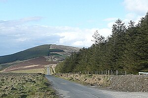
The initial stages run through the Blackstairs Mountains, crossing the flanks of Mount Leinster, the highest mountain in the range to reach the village of Borris. From Borris, the Way follows the towpath of the River Barrow to the town of Graiguenamanagh where it enters County Kilkenny.
The route continues from Graiguenamanagh towards Inistioge, across the northern slopes of Brandon Hill, the highest mountain in County Kilkenny. A series of tracks through forest from Inistioge leads to Mullinavat.
The final stage follows the road from Mullinavat to Carrick-on-Suir.
Connecting paths
- The South Leinster Way forms part of 'European walking route E8', a conceptual route which runs from Dursey Island in County Cork to Constantinople in Turkey. The Irish section incorporates the Wicklow Way, the South Leinster Way, the East Munster Way, the Blackwater Way and parts of the Kerry Way and the Beara Way.
- An umarked road walk connects the trailhead of the Wicklow Way in Clonegal, County Carlow with the start of the South Leinster Way at Kildavin.
- The East Munster Way starts where the South Leinster Way ends in Carrick-on-Suir.[3]
- The Barrow Way connects with the South Leinster Way at Graiguenamanagh.[4]
- The Nore Valley Way is connected at Inistioge.[5]
Outside links
| ("Wikimedia Commons" has material about South Leinster Way) |
- The South Leinster Way
- The South Leinster Way at 'IrishTrails.ie'
References
- ↑ South Leinster Way - IrishTrails (Irish Sports Council)
- ↑ National Trails Office, 2010; p44
- ↑ East Munster Way – IrishTrails (Irish Sports Council)
- ↑ Barrow Way – IrishTrails (Irish Sports Council)
- ↑ Nore Valley Way – IrishTrails (Irish Sports Council)
Books
- Dalby, Barry (2009) [1st pub. 1993]. The Wicklow Way Map Guide. Clonegal, Ireland: EastWest Mapping. ISBN 978-1-899815-24-1.
- Fewer, Michael (1993). Irish Long Distance Walks. A Guide to the Way-Marked Trails. Dublin: Gill & Macmillan. ISBN 0-7171-2040-6.
| Long-distance footpaths in the Republic of Ireland |
|---|
|
National Waymarked Trails: Ballyhoura Way • Barrow Way • Bealach na Gaeltachta, Dún na nGall • Beara Way • Blackwater Way • Bluestack Way • Burren Way • Cavan Way • Croagh Patrick Heritage Trail • Dingle Way • Dublin Mountains Way • East Clare Way • East Munster Way • Grand Canal Way • Hymany Way • Kerry Way • Lough Derg Way • Mid Clare Way • Miners Way and Historical Trail • Monaghan Way • Multeen Way • Nore Valley Way • North Kerry Way • Offaly Way • Royal Canal Way • Sheep's Head Way • Slieve Bloom Way • Slieve Felim Way • Sligo Way • South Leinster Way • Suck Valley Way • Táin Way • Tipperary Heritage Way • Western Way • Westmeath Way • Wicklow Way |
|
Greenways: Boyne Greenway • Dublin-Galway Greenway • Great Southern Trail • Great Western Greenway |
|
Others: Bangor Trail • Malin to Mizen |

