Siddington, Gloucestershire
From Wikishire
| Siddington | |
| Gloucestershire | |
|---|---|
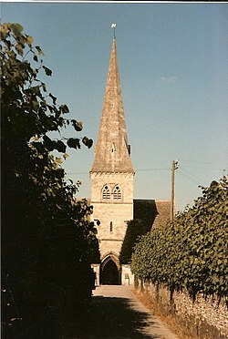
 St Peter's, Siddington | |
| Location | |
| Grid reference: | SU034998 |
| Location: | 51°41’49"N, 1°57’6"W |
| Data | |
| Postcode: | GL7 |
| Local Government | |
| Council: | Cotswold |
| Parliamentary constituency: |
The Cotswolds |
Siddington is a village in Gloucestershire, a mile south of Cirencester. The population was 1,249 at the 2011 census.
The parish church, St Peter's, in parts dates back to Norman times. It has an associated Church of England primary school.
History
William fitzBaderon is recorded in the Domesday Book as holding one hide in Siddington (also Sudintone, Suditone, Suintone); Aswith held it in the time of King Edward, before the Norman conquest of England in 1066. Roger de Lacy held six hides, which his mother held as her dower-land; Godric of Winchcombe and Leofwine, Ealdorman of the Hwicce held the land as two manors. Humphrey the Chamberlain also held two hides in Siddington, which Ansketil held of him, while Alweard held the land as a manor.[1]
Outside links
| ("Wikimedia Commons" has material about Siddington, Gloucestershire) |
References
- ↑ Williams, Dr Ann; Martin, Prof. G H, eds (1992). Domesday Book: A Complete Translation. London: Penguin Books. pp. 460, 463, 471. ISBN 0-14-143994-7.