Difference between revisions of "Ryall, Dorset"
From Wikishire
(Created page with "{{Infobox town |name=Ryall |county=Dorset |picture=Ryall, Hope Cottage - geograph.org.uk - 983774.jpg |picture caption= |os grid ref=SY407949 |latitude=50.751 |longitude=-2.84...") |
(No difference)
|
Latest revision as of 23:03, 21 May 2020
| Ryall | |
| Dorset | |
|---|---|

| |
| Location | |
| Grid reference: | SY407949 |
| Location: | 50°45’4"N, 2°50’34"W |
| Data | |
| Post town: | Bridport |
| Local Government | |
| Council: | Dorset |
| Parliamentary constituency: |
West Dorset |
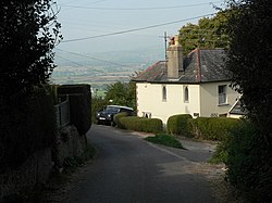
Ryall is a small village in Dorset, a place which is home to about 200 people in 60 houses. It is in the west of the county, standing in the jumble of hills which spread inland from this part of Dorset's south coast, and is found roughly midway between the towns of Bridport and Lyme Regis, with the county town of Dorchester about twenty miles to the east.
The village stands on the northern slopes of Hardown Hill, about two miles inland from the coast, a stretch known as the Jurassic Coast (a World Heritage Site).
To the north the village looks across the Marshwood Vale towards a line of hills including Pilsdon Pen.