River Brent

The Brent is a river within Middlesex 18 miles long, running north-east to south-west, until it falls into the Thames on the Tideway at Brentford.
The Brent is one of the larger rivers of Middlesex, and has not been driven underground in the way that many have. It is forced through the suburban wastes and been dammed to serve a reservoir, but also beautifies several green spaces, and at it lower reach it serves commercial barge traffic.
Contents
Name of the river
The river's name is assumed to be of Celtic origin. The earliest form known is in a letter from the Bishop of London in the year 705 calling a meeting at Bregentford (Brentford), and it is assumed that Brentford is named for the river, rather than the river name being a back-formation from that of Brentford. There is no clear Old English root that would give this form Bregent, pronounced brejent; the closest in Englisc is the word meaning "terrifying" which would be written bregend, and it is suggested that the name Bregent may be related an older, British-language root brigant- meaning "high" or "elevated" or from the name of a pagan goddess. We cannot know for sure but that the name of the Brent is old.
Course

The River Brent begins with the joining of two brooks: the Dollis Brook and the Mutton Brook, which meet close to Bridge Lane in Hendon.
The main tributary is the Dollis Brook, around 6 miles long, which rises in Mill Hill, and flows eastward through fields and open space to King George V Playing Fields at the edge of Totteridge, forming the Middlesex-Hertfordshire boundary for some way. The Mutton Brook rises in Cherry Tree Wood, East Finchley and flows westward, underground, until it comes out shortly after The Bishop's Avenue, and then through parks next to Lyttelton Road, Falloden Road and North Circular Road to meet the Dollis Brook.
The Decoy Brook joins the Brent at Riverside Drive in Hendon.[1] Another, Clitterhouse Stream, made of streams rising on Hampstead Heath, joins the Brent at Brent Cross, at the eponymous shopping centre.
The River Brent flows with the A406 North Circular Road alongside, through Brent Park and thence to Brent Cross. There is enters the Brent Reservoir, more commonly known as Welsh Harp.
Welsh Harp is a reservoir which takes the waters of the Brent and its tributary, the Silk Stream. A dam at Neasden floods the valley to create a manmade lake of 110 acres (and at its greatest extent in 1853 it covered 400 acres). Welsh Harp is officially named "Brent Reservoir" and was created to supply the Paddington Canal, now an arm of the Grand Union. Welsh Harp has since its creation been is a popular place for leisuretime for Middlesex folk, and remains so. It is also an important wildlife habitat.
The Brent escapes Welsh Harp below the dam at Neasden and with the North Circular Road still closely following in its valley, the Brent passes Stonebridge Park, south of Wembley, and under an aqueduct carrying the Paddington Arm of the Grand Union Canal. From Stonebridge Park the river can be followed westward, under the A40 Western Avenue where at last it is permitted to resume as a river should, meandering through fields, first to the Tokyngton Recreation Ground in Harlesden and to the adjacent Brent River Park[2] for 3 miles until it reaches Greenford.

The stretch of the Brent through the southern boundary of Greenford Golf Course, was dredged deeper in the 1960s and a control weir built, to reduce the risk of flooding, especially of Costons Lane, along which there is a flood protection wall. Previously, Ruslip Road East would also regularly become impassable.
South of Greenford the river follows on to Hanwell, a mile away across the fields, followed by the local cyclepath, and soon comes to another rpark: Perivale Park.[3] The river flows on through Longfield / Perivale East Meadow and Pitshanger Riverside meadows.,[3] past the parish church, St Mary's Church and under the Great Western Railway at the 900-foot-long Wharncliffe Viaduct, which carries the main line railway from Paddington to the western counties.

Within about 500 yards of the viaduct, the River Brent is joined from the west by the main line of the Grand Union Canal at the foot of a flight of locks. After passing through Brentford Gauging Locks[4] it reaches Brentford Dock.
From the Brent Docks, he river is canalised and navigable, forming the southernmost part of the Grand Union Canal through Osterley, Osterley Lock and a further two locks before joining the tidal River Thames at Old Brentford.[5]
In poetry
Poet Laureate Sir John Betjeman in his poem Middlesex, wrote:
Gentle Brent, I used to know you
Wandering Wembley-wards at will,
Now what change your waters show you
In the meadowlands you fill!
Recollect the elm-trees misty
And the footpaths climbing twisty
Under cedar-shaded palings,
Low laburnum-leaned-on railings
Out of Northolt on and upward to the heights of Harrow hill.
History
Evidence of the hand of man, even since Romans days, may lie next to the original banks of the Brent but have been buried under centuries of silt.[6]
The most prominent pre-Roman settlement on the River Brent was apparently at Brentford. This Bronze Age site pre-dates the Roman occupation of Britain: many pre-Roman artifacts have been excavated in and around the area in Brentford known as 'Old England'. The quality and quantity of the artefacts suggests that Brentford was a meeting point for Iron Age tribes. One well known Iron Age piece from about 100 BC - AD 50 is the Brentford horn-cap - a ceremonial chariot fitting that formed part of local antiquarian Thomas Layton's collection,[7] now held by the Museum of London. Odd Roman artifacts have all so been found by the River Brent, at Brentford and Hanwell, suggesting that a trading route may have used the river to trade with the early villages in Roman and post-Roman times.
The Brent river valley in 705, the time of the Brentford Synod, would have looked very different from that of today. Before modern day dredging the river was wider and shallower. Before the construction of its weirs, the Brent reservoir and Grand Union Canal (and its Paddington Branch, which takes much of the Brent's waters) the river would have flooded more frequently than it does today. The alluvial valley floor would therefore have been swamp. From the air, the signs of many of the old drainage channels that turned the marsh into water meadow are still visible. Bordering these marshes would have been dense thickets of thorn and willow.
Today, the valley of the Brent is almost all swallowed up in the Middlesex suburbs. The river water is drained away for the canals and for flushing drains, much is canalised and the meadows have been built upon.

Historical interest
Brentford was a likely site of a battle recorded by Julius Cæsar between Julius Cæsar and local king, Cassivellaunus, in 54 BC. It is recorded that Cassivellaunus order that sharpened stakes be placed in the river to repel the Romans attempting the ford. A stake from the river (whether or not one placed by the king we cannot tell) was excavated under the direction of Sir Montagu Sharpe and held at the Middlesex Guildhall, until transferred to the Middlesex Guildhall Collection in the 1970s.
A letter from the Bishop of London in AD 705 suggesting a meeting at Breguntford, now Brentford, is the earliest record of this place and impliedly of the river.
Industrial heritage

Brentford Dock
Brentford Dock was a major trans-shipment point between the Great Western Railway and barges on the River Thames. The building of Brentford Dock was started in 1855 [8] and it was formally opened in 1859. The dockyard was redeveloped in 1972 and is now Brentford Dock Marina and Brentford Dock Estate.[9]
Welsh Harp

The Brent Reservoir, popularly called Welsh Harp, is a reservoir formed of the dammed valleys of the Brent and the Silk Stream at Hendon. The reservoir takes its informal name from a public house called The Welsh Harp, which stood nearby until the early 1970s.
In a recent survey, a large number fish were captured in the reservoir and a joining parts of the River Brent and Silk Stream, 95% of which were roach. However, fishing is prohibited in the reservoir itself.
Environmental regeneration

The Brent River and Canal Society volunteer group was founded in 1972 by several Hanwell residents, lead by Luke Fitzherbert, under the umbrella of Hanwell Preservation Society, had taken the initiative to clear the river of two years' worth of dumped rubbish. The society went on to campaign vigorously in the 1970s for the creation of Brent River Park, which was set up in 1975, saving it from a plan for flood alleviation. Ultimately, this campaign helped to achieve the Brent River and Canal Society objectives of a continuous urban walk along the river’s course from Hanger Lane to Brentford.
The 'River Brent Project' regeneration scheme is aimed at improving the local environment, wild live habitat and flood prevention among other things.[2][10][10][11]
Notable floods
The earliest flood record was in 1682.
- 1682: A very violent storm of rain, accompanied with thunder and lightning, caused a sudden flood, which did great damage to the town of Brentford. The whole place was overflown; boats rowed up and down the streets, and several houses and other buildings were carried away by the force of the waters.[12][12]
- 1841: Brentford was flooded by the Brent Reservoir's becoming overfilled, so that the overflow cut a breach in the earth dam. A wave of frothing and roaring water swept down the river's course taking all before it causing fatalities. Several were lives lost.
- 1976: In the summer of 1976 Britain experienced its worst drought since records began; with Water Companies declaring it would take six or seven years for their empty, dry reservoirs to fill again. However, in August the following year, torrential rain not only filled but overwhelmed the Brent reservoir again, forcing the sluice gate to be opened to their fullest extent. It carried on raining heavily throughout the night. Even before the river broke its banks, the drains had started to overflow with sewerage. People awoke during the night to find their homes flooded. Streets were grid-locked and trains could not run. Hundreds ended up homeless and hundreds of shops and businesses had to close to clear up the mess. Roads that were unaffected by the water and sewage were awash with the dozens and dozens of news-crews covering the mayhem.
- 2007: August saw heavy rain cause a short bout of flash flooding in Brentford and Hanwell which covered several roads and disrupted both road and rail travel.
- 2009: On 30 November the Environment Agency warned residents of a flooding along River Brent from Hendon to Brentford, after a day of notably heavy rain. Several premises were temporarily flooded in Brentford and Perivale.[13]
Pictures
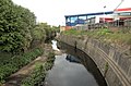
The Brent at Brent Cross
Drain outflow into the River Brent
The Brent at Vicar's Bridge, Alperton
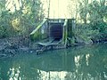
A storm drain discharging
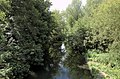
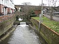
The Brent at Hanwell Bridge
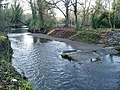
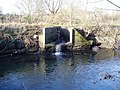
Remains of a weir on the Brent
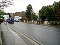
Hanwell Bridge, Uxbridge Road
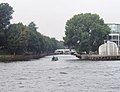
The Brent enters the Thames; a barge heads up the Brent


Outside links
- The Waterways of Brent
- Fiollowing the Brent - Middlesex County Council.org.uk
References
- ↑ Decoy Brook
- ↑ 2.0 2.1 Brent River Park Regeneration Project
- ↑ 3.0 3.1 Perivale.co.uk - River Brent, Perivale, Greenford, Middlesex
- ↑ Grand Union Canal Walk - Brentford to West Drayton
- ↑ Hanwell canals: Waterscape.com
- ↑ The Physique of Middlesex, A History of the County of Middlesex: Volume 1: Physique, Archaeology, Domesday, Ecclesiastical Organization, The Jews, Religious Houses, Education of Working Classes to 1870, Private Education from Sixteenth Century (1969), pp. 1-10. Date accessed: 11 August 2007.
- ↑ Museum of London archive
- ↑ Brentford Dock History
- ↑ Brentford Dock's 150th Anniversary
- ↑ 10.0 10.1 The River Restoration Centre - River Brent Projects Map
- ↑ The River Restoration Centre - case maps
- ↑ 12.0 12.1 Brentford, The Environs of London: volume 2: County of Middlesex (1795), pp. 39-58. . Date accessed: 18 August 2007.
- ↑ Flood warning for River Brent (From Richmond and Twickenham Times)