Ring's End
From Wikishire
| Ring's End | |
| Cambridgeshire | |
|---|---|
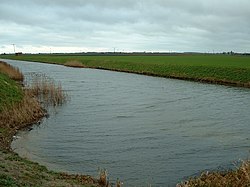
 The Twenty Foot River, near Ring's End | |
| Location | |
| Grid reference: | TF398027 |
| Location: | 52°36’17"N, 0°3’49"E |
| Data | |
| Postcode: | PE13 |
| Local Government | |
| Council: | Fenland |
Ring's End is a hamlet in the Cambridgeshire fens. It is found just south of Guyhirn, where Morton's Leam, a non-tidal drain, joins the tidal River Nene (new course), at a sluice. The hamlet is lined along the A141 March to Guyhirn road, constrained against the road and the fen and leam.