Otley
| Otley | |
| Yorkshire West Riding | |
|---|---|
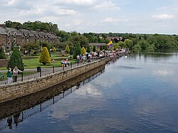
 The River Wharfe at Otley | |
| Location | |
| Grid reference: | SE205455 |
| Location: | 53°54’18"N, 1°41’13"W |
| Data | |
| Population: | 14,124 (2001) |
| Post town: | Otley |
| Postcode: | LS21 |
| Dialling code: | 01943 |
| Local Government | |
| Council: | Leeds |
| Parliamentary constituency: |
Leeds North West |
Otley is a market town in the West Riding of Yorkshire. It stands in Wharfdale, on each bank of the River Wharfe, to the northwest of Leeds. Above the town overlooking the dale is a ridge known as The Chevin.
The main part, original part of the town is on the south bank of the river.
Contents
Names
Otley's name is assumed to come from an Anglo-Saxon progenitor otherwise unknown perhaps by the name Othe, Otho or Otta, with and leah meaning woodland clearing. The town was recorded as Ottanlege in 972 and Otelai or Othelia in the Domesday Book of 1086.[1][2]
While Otley may be Old English, the Chevin above the town appears to be from the Old Welsh spoken in the Kingdom of Elmet; the Welsh for "ridge" is Cefn.
History
Early history
Otley is close to Leeds and may have formed part of the kingdom of Elmet, a kingdom of the native Britons which survived in the Pennines hereabouts until the seventh century.
The town of Otley dates from Anglo-Saxon times and was part of an extensive manor granted by King Athelstan to the Diocese of York. The Archbishops of York had a residence and were lords of the manor. Their palace was located on the site occupied by the Manor House.[2] Remains of the Archbishop's Palace were found during the construction of St Joseph's School.
The town grew in the first half of the 13th century when the archbishops laid out burgage plots to attract merchants and tradespeople. The burgage plots were on Boroughgate, Walkergate and Kirkgate. Bondgate was for tenants who did not have 'burgage' privileges. A leper hospital was founded on the road to Harewood beyond Cross Green.[3]
Documented history for the market begins in 1222 when King Henry III granted the first Royal Charter. The town had two cattle markets, Wharfedale Farmers' Auction Mart on East Chevin Road and the Bridge End Auction Mart which has closed and was subsequently demolished. Market days are Tuesday, Friday and Saturday, and there is a Farmers' Market on the last Sunday of every month.
A grammar school was founded by Thomas Cave who named it "The Grammar School of Prince Henry." It is built in the Elizabethan style and also used as a court-house.[2] Its successor is Prince Henry's Grammar School, Otley in Farnley Lane.
Thomas Chippendale, the cabinetmaker, was born in a cottage at the junction of Boroughgate and Wesley Street[3] and his statue stands next to the old Grammar School that he once attended in Manor Square. JMW Turner, the painter, visited Otley in 1797, aged 22, when commissioned to paint watercolours of the area. He was so attracted to Otley and the surrounding area that he returned time and time again. His friendship with Walter Ramsden Fawkes made him a regular visitor to Farnley Hall, two miles from Otley. The stormy backdrop of Hannibal Crossing The Alps is reputed to have been inspired by a storm over the Chevin while Turner was staying at Farnley Hall.
Industrial revolution
The woollen industry developed as a cottage industry but during the Industrial revolution and the mechanisation of the textile industry, mills were built using water then steam power. A cotton mill and weaving shed for calicoes were built by the river in the late 18th-century. Later, woolcombing and worsted spinning were introduced.[3] By the mid 19th century 500 inhabitants were employed in two worsted-mills, a paper-mill, and other mills.[2] A tannery was established in the 19th-century.[3]
The Wharfedale Printing Machine was developed in Otley by William Dawson and David Payne.[4] An early example can be seen in Otley Museum. By 1900 the printing machinery trade, with over 2,000 people employed in seven machine shops was Otley's most important industry.[3]
Geography
Otley lies 28 miles south-west of York, 10 miles north-west of Leeds, 10 miles north-east of Bradford, and 196 miles from London. The town lies in lower Wharfedale at a bridging point of the River Wharfe where there is a seven arched bridge and is surrounded by arable farmland. The south side of the valley is dominated by a gritstone escarpment overlooking Otley called The Chevin and to the north is Newall Carr.[2] In 1944, Major Le G.G.W. Horton Fawkes of Farnley Hall donated 263 acres of land on the Chevin to the people of Otley. This has been expanded to 700 acres and constitutes Chevin Forest Park. It was from a quarry on the Chevin that the foundation stones for the Houses of Parliament were hewn.
To the east and west of Otley are flooded gravel pits, where sand and gravel have been extracted in the 20th century. The gravel pits to the east at Knotford Nook are a noted birdwatching site. Those to the west are devoted to angling and sailing.
To the west are the villages of Burley-in-Wharfedale and Menston. To the east is Pool-in-Wharfedale.
Churches
Otley's first church was built in the early 7th century. In All Saints Parish Church there are the remains of two early Anglo-Saxon crosses, one of which has been reproduced for the town's war memorial. Its church was the centre of an ancient ecclesiastical parish which comprised the chapelries of Baildon, Bramhope, Burley in Wharfedale, Denton, and Farnley, and the townships of Esholt, Hawksworth, Lindley, Menston, Newall with Clifton, Pool-in-Wharfedale, and Little Timble.
All Saints Church dates from the 12th century and was built in the Norman style but little of the original remains, except the north doorway.[2][5]
Buried in the graveyard is an ancestor of the 19th century American poet Henry Wadsworth Longfellow, and the grandparents of Thomas Fairfax who commanded Parliament's forces at the Battle of Marston Moor in 1644. In the graveyard of the parish church stands a replica of the entrance to Bramhope Tunnel, a monument to those killed during its construction.
John Wesley was a frequent visitor to the town in the 18th century. Allegedly his horse died in the town and is buried in the grounds of the parish church. Its grave is marked by an unusual stone, also known locally as the "Donkey Stone". His Journal for 1761 reads, "6 July Monday; In the evening I preached at Otley and afterwards talked with many of the Society. There is reason to believe that ten or twelve of these are filled with the love of God." Wesley Street is named after him.
Culture and community
Otley has a diverse range of cultural organisations. It has five active Morris dance sides, the Wharfedale Wayzgoose, (Border),[6] The Buttercross Belles (Ladies Northwest), Flash Company (Border, Molly, Appalachian & Clog), Hellz Bellz (Contemporary) and Kitchen Taps (Appalachian Step).
Drama groups include Otley Community Players, Otley Youth Theatre (OY) and a thriving arts centre in the former courthouse. There is a poetry society which meets in the Black Horse Hotel monthly. The town has a Brass Band who perform at many events in the town. It is not a regular contesting band, but won first prize in the unregistered section at their first contest at Hardraw Scar in September 2007, repeating the accomplishment in 2008.
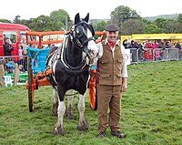
Otley hosts the annual Otley Folk Festival in September, a |Victorian Fayre in December, a carnival in June and in May, what is reputed to be the oldest one day agricultural show in the country. This celebrated its bicentenary in 2009. There is a beer festival organised by the church in November.
Otley once vied with a handful of towns for the distinction of having the most pubs per head of population in England. It was mentioned in a BBC Radio 4 "More or Less" programme broadcast in April 2008. The story was also reported by the BBC.[7]
There were 17 pubs in the town although the Spite (properly known as the Roebuck), the Chevin and the Royalty are on the outskirts, with the Spite a little further out. The Black Horse Hotel situated in the town centre is historically the largest pub and hotel. The Black Bull in the Market Place, was allegedly drunk dry by Cromwell's troops on the night before the battle of Marston Moor during the English Civil War and has a 15th-century well in the beer garden. The Junction Inn has won numerous awards including a CAMRA award for best pub. There is a working men's club located on Weston Lane north west of the town centre.
Otley has four Scout troops, the 2nd Otley, Otley Parish, Otley Bridge and Otley Methodist Scouts.[8] An Army Cadet Force detachment is also located in the town.
Otley on film and television
Otley is "Hotton" in the ITV television soap opera Emmerdale, and appears in ITV's Heartbeat where Otley Courthouse is the old Police Station. The town was the setting for the drama series The Chase and the ITV dramatisation of The Bad Mother's Handbook.
Sport
- Rugby: Otley RUFC. Their home ground, Cross Green, was the venue for the Italy v USA fixture in the 1991 Rugby World Cup. In 1979 at Cross Green the North of England defeated the All Blacks,[9] and in 1988 Australia too.
- Football: Otley Town Football Club
- Cricket: Otley Cricket Club, founded in 1820
- Angling: Otley Angling Club, formed in 1897 by local land owners. It controls the fishing on the River Wharfe through Otley and a coarse fishing pond on the outskirts of the town.[10]
Outside links
| ("Wikimedia Commons" has material about Otley) |
- Otley Town Council
- Otley Online
- Virtual Tour of Otley centre, and interactive map
- All Saints Church, Otley
- The Otley Brass, Palmes Family, 1593, All Saints Church, Otley
- Otley in Bloom
- Otley Courthouse Arts and Resource Centre
- Otley Amateur Radio Society
- Otley Beer Festival
- 2nd Otley Scout Group
References
- ↑ Mills 1998, p. 263
- ↑ 2.0 2.1 2.2 2.3 2.4 2.5 Samuel Lewis: Otley, (All Saints) in A Topographical Dictionary of England, pp 369–372
- ↑ 3.0 3.1 3.2 3.3 3.4 Otley Conservation Area, West Yorkshire Joint Services, http://www.archaeology.wyjs.org.uk/documents/archaeology/ConsOtl.pdf, retrieved 2011-01-16
- ↑ Otley Museum website
- ↑ The Ancient Parish of Otley, GenUKI, http://www.genuki.org.uk/big/eng/YKS/WRY/Otley/index.html, retrieved 2011-01-16
- ↑ Wharfedale Wayzgoose Borders Morris Side, Waygoose, http://www.wharfedale-wayzgoose.co.uk/, retrieved 2011-01-16
- ↑ BBC Magazine
- ↑ Wharfedale District Scouts, Retrieved 2011-05-27
- ↑ "TV screening of Otley's historic rugby day". Telegraph & Argus. Newsquest Media Group. 16 September 2004. http://archive.thetelegraphandargus.co.uk/2004/9/16/97284.html. Retrieved 2008-04-23.
- ↑ Otley Angling Club
Books
- Mills, A.D. (1998), Dictionary of English Place-Names, Oxford, ISBN 0-19-280074-4


