Offa's Dyke Path
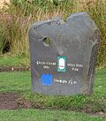
Offa's Dyke Path is a long-distance footpath running between the Severn Estuary in Gloucestershire and the Irish Sea in Flintshire along the line of Offa's Dyke (map). It approximates the boundary between the counties of Wales and those of England. It was opened in 1971, and draws walkers from across the world.
The path is 177 miless long and the route either follows, or keeps close company with, the remnants of Offa's Dyke, an 8th-century defensive earthwork built on the orders of Mercian King Offa to mark his western border.
The trailheads are at Sedbury Cliffs in Gloucestershire (near Chepstow in Monmouthshire), at ST555927 on the Severn Estuary in the south, and Prestatyn in Flintshire at SJ068839 on the Irish Sea in the north.
Contents
Walking
Most walkers travel south to north, starting by the Severn Estuary at Sedbury and finishing at Prestatyn on the Irish Sea. The walk will take an average walker roughly 12 days to complete, although this can vary depending on individual fitness, attitude, the weather, age and experience.
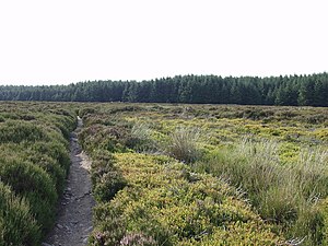
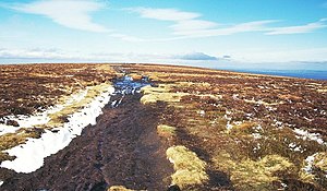
Following a man-made border and ancient monument, rather than natural features, the dyke crosses a variety of different landscapes. The route crosses the Black Mountains, the Shropshire Hills (including the many ups and downs of the 'Switchback', for many walkers the hardest part of the walk), the Eglwyseg moors north of Llangollen, and the Clwydian Range.
It passes through or close to, from south to north: Chepstow, Monmouth, Abergavenny, Hay-on-Wye, Kington, Knighton, Montgomery, Llangollen, Llandegla, Clwyd Gate, Bodfari and Dyserth.
The half-way point of the walk is marked by the Offa's Dyke Centre in Knighton in Radnorshire (SO285720).[1]
| “ | There was in Mercia in fairly recent times a certain vigorous king called Offa who terrified all the neighbouring kings and provinces around him, and who had a great dyke built between Wales and Mercia from sea to sea. | ” |
Promotion
Various bodies collaborate on a sustainable tourism partnership, a principle focus of which is Walking with Offa, both on the trail but also in what has been dubbed Offa's Country, which is to say in a corridor through these county borders. Partnerships have been developed between the bodies responsible for the four protected landscapes along the corridor, namely Brecon Beacons National Park, Clwydian Range AONB, Shropshire Hills AONB and the Wye Valley AONB together with the Offa's Dyke National Trail. Various other local and quasi-governmental bodies are also involved.
Outside links
| ("Wikimedia Commons" has material about Offa's Dyke Path) |
References
- ↑ Offa's Dyke Association - The Offa's Dyke Centre in Knighton


