Normanton on Trent
| Normanton on Trent | |
| Nottinghamshire | |
|---|---|
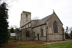
 St Matthew's parish church | |
| Location | |
| Grid reference: | SK790690 |
| Location: | 53°13’12"N, 0°49’12"W |
| Data | |
| Population: | 345 (2011) |
| Post town: | Newark |
| Postcode: | NG23 |
| Local Government | |
| Council: | Bassetlaw |
| Parliamentary constituency: |
Newark |
Normanton on Trent is a village and parish in the Thurgarton Wapentake of Nottinghamshire. It is nine miles south-east of Retford.
According to the 2001 census it had a population of 299,[1] increasing to 345 at the 2011 census and including Low Marnham.[2] In 1848, it had 362 inhabitants. [3]
The parish church of St Matthew is a Grade-II* listed building, dating from the 13th century. [4] Other listed buildings in Normanton include the Grade-II listed Manor House on South Street; Normanton Hall on Main Street; and the former School House also on Main Street. The latter has an inscription: "Henry Jackson of this town Gent built and endowed this school for four pounds a year for the education of ten poor children belonging to this parish Anno Dom 1776". [5]
There are two public houses, however there are no shops. The nearest shop is the Co-Op, in Sutton-on-Trent. There is a Primary school in Normanton-on-Trent, St Matthews C of E Primary school.
References
- ↑ "Area: Normanton on Trent CP (Parish)"
- ↑ "Civil Parish population 2011". Neighbourhood Statistics. Office for National Statistics. http://www.neighbourhood.statistics.gov.uk/dissemination/LeadKeyFigures.do?a=7&b=11127014&c=Normanton+on+Trent&d=16&e=62&g=6456340&i=1001x1003x1032x1004&m=0&r=1&s=1460455509056&enc=1. Retrieved 12 April 2016.
- ↑ "A Topographical Dictionary of England. Originally published by S Lewis, London, 1848.". https://www.british-history.ac.uk/topographical-dict/england/pp421-423#h3-0024. Retrieved 6 August 2020.
- ↑ Pevsner, Nikolaus. 1979. The Buildings of England: Nottinghamshire. page 210. Harmondsworth, Middx. Penguin.
- ↑ "Listed Buildings in Normanton on Trent, Bassetlaw, Nottinghamshire". https://britishlistedbuildings.co.uk/england/normanton-on-trent-bassetlaw-nottinghamshire#.XywhbChKhPY. Retrieved 6 August 2020.
| ("Wikimedia Commons" has material about Normanton on Trent) |