Newport, East Riding
From Wikishire
| Newport | |
| Yorkshire East Riding | |
|---|---|
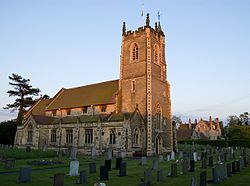
 St Stephen's Church, Newport | |
| Location | |
| Grid reference: | SE858304 |
| Location: | 53°45’47"N, 0°41’60"W |
| Data | |
| Population: | 1,538 (2001) |
| Post town: | Brough |
| Postcode: | HU15 |
| Dialling code: | 01430 |
| Local Government | |
| Council: | East Riding of Yorkshire |
| Parliamentary constituency: |
Haltemprice and Howden |
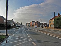
Newport is a village in the East Riding of Yorkshire. It has a parish church, St Stephen's, a village school, a few shops, a couple of pubs and two play parks.
The village lies approximately 7 miles east of the town of Howden, on the B1230 road to the south of the M62 motorway. The Market Weighton Canal passes through the village.
According to the 2001 census, Newport parish then had a population of 1,538.
References
|
