Difference between revisions of "Newbridge-on-Wye"
m (Owain moved page Newbridge on Wye to Newbridge-on-Wye) |
|||
| (One intermediate revision by the same user not shown) | |||
| Line 2: | Line 2: | ||
|name=Newbridge-on-Wye | |name=Newbridge-on-Wye | ||
|county=Radnorshire | |county=Radnorshire | ||
| − | |picture= | + | |picture=All Saints Church, Newbridge on Wye - geograph.org.uk - 158756.jpg |
| − | |picture caption= | + | |picture caption=All Saints Church |
|os grid ref=SO0149058333 | |os grid ref=SO0149058333 | ||
|latitude=52.214 | |latitude=52.214 | ||
| Line 15: | Line 15: | ||
|constituency=Brecon & Radnorshire | |constituency=Brecon & Radnorshire | ||
}} | }} | ||
| − | '''Newbridge-on-Wye''' is a small village in [[Radnorshire]]. It lies, as its name suggests, on the [[River Wye]] | + | '''Newbridge-on-Wye''' is a small village in [[Radnorshire]]. It lies, as its name suggests, on the [[River Wye]] which here forms the county boundary with [[Brecknockshire]]. It lies seven miles downstream from the market town of [[Rhayader]]. |
== Location == | == Location == | ||
| − | Newbridge-on-Wye is located roughly in the middle of Wales | + | Newbridge-on-Wye is located roughly in the middle of Wales. The main road running through the village is the A470, running from Rhayader to the north and [[Builth Wells]] to the south. The B4358 also passes through the village; it runs from [[Beulah, Brecknockshire|Beulah]] in the west through to [[Llandrindod Wells]] in the east. This road system is useful for commuters traveling from west and north-west Wales to areas in the south. |
== History == | == History == | ||
Latest revision as of 14:59, 27 October 2014
| Newbridge-on-Wye | |
| Radnorshire | |
|---|---|
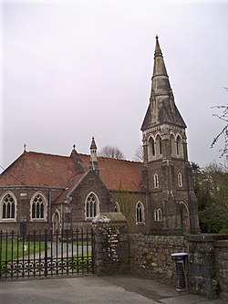
 All Saints Church | |
| Location | |
| Grid reference: | SO0149058333 |
| Location: | 52°12’50"N, 3°26’31"W |
| Data | |
| Post town: | Llandrindod Wells |
| Postcode: | LD1 |
| Dialling code: | 01597 |
| Local Government | |
| Council: | Powys |
| Parliamentary constituency: |
Brecon & Radnorshire |
Newbridge-on-Wye is a small village in Radnorshire. It lies, as its name suggests, on the River Wye which here forms the county boundary with Brecknockshire. It lies seven miles downstream from the market town of Rhayader.
Location
Newbridge-on-Wye is located roughly in the middle of Wales. The main road running through the village is the A470, running from Rhayader to the north and Builth Wells to the south. The B4358 also passes through the village; it runs from Beulah in the west through to Llandrindod Wells in the east. This road system is useful for commuters traveling from west and north-west Wales to areas in the south.
History
Newbridge-on-Wye was historically a stop off point for drovers, who moved livestock from place to place. Newbridge-on-Wye proved to be an ideal location for drovers to stop and rest because it afforded a safe crossing-point on the river Wye. This led to a settlement forming, including a large number of pubs. This fact is celebrated by the statue of a drover on the village green. Newbridge-on-Wye also sited a railway station on the Mid Wales Railway, until its closure on December 31, 1962. The site of the station is now occupied by a housing estate, although the old railway bridge still remains.
References
This Radnorshire article is a stub: help to improve Wikishire by building it up.