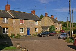
Nettlecombe, Dorset
From Wikishire
Revision as of 20:40, 20 April 2017 by RB (Talk | contribs) (Created page with "{{Infobox town |name=Nettlecombe |county=Dorset |picture=The Square, Nettlecombe - geograph.org.uk - 1030188.jpg |picture caption=The Square, Nettlecombe |os grid ref=SY518955...")
| Nettlecombe | |
| Dorset | |
|---|---|
 The Square, Nettlecombe | |
| Location | |
| Grid reference: | SY518955 |
| Location: | 50°45’27"N, 2°41’4"W |
| Data | |
| Post town: | Bridport |
| Postcode: | DT6 |
| Local Government | |
| Council: | Dorset |
Nettlecombe is a little village in western Dorset, sitting in a steep valley in the crumpled geography at the edge of the Dorset Downs. It is five miles north-east of the market town of Bridport.
Powerstock is half a mile to the north.