Mickley, Yorkshire
From Wikishire
| Mickley | |
| Yorkshire West Riding | |
|---|---|
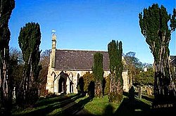
 St John's, Mickley | |
| Location | |
| Grid reference: | SE265768 |
| Location: | 54°11’17"N, 1°36’47"W |
| Data | |
| Postcode: | HG4 |
| Local Government | |
| Council: | Harrogate |
Mickley is a small village on the south bank of the River Ure in the West Riding of Yorkshire: the river here, unbridged at Mickley, forms the boundary with the North Riding of Yorkshire. The village is in Wensleydale, the Ure's own dale, just as it begins to become gentler below the Pennine moorland.
To the west, a lane runs up to Grewelthorpe, a village barely larger on the slope of the dale, and lanes run eastward to the A6018 and North Stainley. To the northeast is West Tanfield, on the north bank of the river and thus in the North Riding.
The Ripon Rowel Walk, a long path making a ring through this part of the riding, runs through Mickley on it way down Wensleydale to Ripon, where it starts and finishes.