Mayar
| Mayar | |
| Angus | |
|---|---|
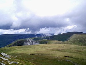
 The path from Mayar to Driesh | |
| Summit: | 3,045 feet NO240737 56°50’55"N, 3°14’51"W |
Mayar is a mountain in Angus, which reaches a height of 3,045 feet at its summit, and so it qualifies as a Munro.
Mayar is a little west of fellow Munro, Driesh, and these two are the most southern Munros in the region. They sit at either end, of a long plateau separating Glen Clova to the north and Glen Prosen to the south.
Mayar rises a little from the actual plateau. When viewed from the south the hill looks like an area of high moorland with little in the way of features. The north face however is a different story, where a series of deep corries bite into the Munro above Glen Doll.
Ascent
The usual ascent route is up most western corrie, Corrie Fee. It is a steep climb up the corrie headwall but refreshing. From the summit, a long ridge or col stretches west to Driesh - along a sharp col called "The Shank"; from here it is easy slopes all the way to the summit of Driesh.
The easiest starting point to bag both Driesh and Mayar is Glen Doll Lodge to the north-east, where there is parking available.
| Munros in SMC Area SMC Section 7 - Glenshee to Mount Keen |
|---|
|
Broad Cairn • Cairn Bannoch • Cairn of Claise • Càrn a' Choire Bhoidheach • Càrn an t-Sagairt Mor • Càrn an Tuirc • Creag Leacach • Driesh • Glas Maol • Lochnagar • Mayar • Mount Keen • Tolmount • Tom Buidhe |