Little Langdale Tarn
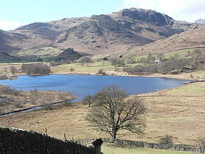
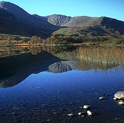
Little Langdale Tarn is a natural tarn within a marshy area of Little Langdale, in the valley floor.
The area around the tarn is managed by the National Trust and has no public access. It is typical Lakeland meso-oligotrophic tarn,[1] whilst not at a particularly high altitude itself it has a mean catchment altitude 1,710 feet.
The tarn and approximately 74 acres of its fringing habitats were designated a SSSI in 1965. The habitat types next to the tarn are 'single-species dominant swamp, acid-poor fen, acidic species-rich marshy grassland, hay meadow and wet woodland'. It was surveyed for diatoms in 1984 and 1999, the changes being consistent with the pH of the lake having increased.
Little Langdale Tarn was several times larger at the end of the last Ice Age; the lost area has become filled with sediment and resulted in the flat farmland beside the current lake. The catchment area is a sheep farm of rough grassland and sphagnum bog in the valley bottom and surrounding fellside. Sediment cores taken at the lake show a top layer of brown organic sediment followed by a grey coloured minerogenic layer rich in copper from the mining activities at Greenburn. There is an obvious increase in the sediment accumulation rate with time - the major source being peat pipes and sheep grazing close to Wrynose Beck, a tributary of the River Brathay.
Outside links
| ("Wikimedia Commons" has material about Little Langdale Tarn) |
- Location map: 54.41972 -3.06611
- OS map: NY308032
Refernces
- ↑ SSSI listing and designation for Little Langdale Tarn

