Libberton
Libberton is a parish in the Upper Ward of Lanarkshire. It contains the village and ancient parish of Quothquan which was united to it in 1669. It is bounded by Carnwath to the north; by Walston to the east; by Biggar to the south-east; by Symington to the south; by Covington to the south-west; and by Pettinain to the north-west. The population in 2001 was 467.
The River Clyde forms the parish's western and southern boundaries, with the Medwin Water and its tributary the South Medwin forming the northern. The highest point is Quothquan Law at 1,096 ft.
The B7016 road between Biggar and Carnwath passes through the parish, with the nearest railway station at Carstairs Junction on the West Coast Main Line just to the north-west.
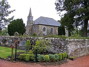
The present parish church was built in 1812 and contains a plaque recording ancestors of British Prime Minister Gladstone.
Outside links
- Location map: 55°39’22"N, 3°34’52"W
This Lanarkshire article is a stub: help to improve Wikishire by building it up.
