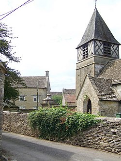
Leighterton
From Wikishire
| Leighterton | |
| Gloucestershire | |
|---|---|
 The Church of St Andrew | |
| Location | |
| Grid reference: | ST823909 |
| Location: | 51°37’1"N, 2°15’25"W |
| Data | |
| Post town: | Tetbury |
| Postcode: | GL8 |
| Local Government | |
| Council: | Cotswold |
| Parliamentary constituency: |
The Cotswolds |
Leighterton is a village in rural Gloucestershire off the A46 road.
The Monarch's Way long-distance walking route passes through the village.
Outside links
| ("Wikimedia Commons" has material about Leighterton) |