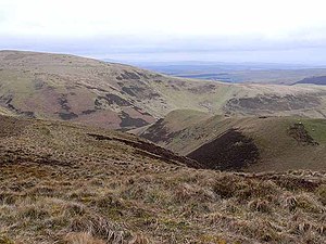
Lamb Hill, Cheviot Hills
From Wikishire
Revision as of 21:32, 2 September 2015 by RB (Talk | contribs) (Created page with "{{Infobox hill |name=Lamb Hill |county 1=Northumberland |county 2=Roxburghshire |range=Cheviot Hills |picture=Looking into Scotland from Lamb Hill - geograph.org.uk - 1221697....")
| Lamb Hill | |||
| Northumberland, Roxburghshire | |||
|---|---|---|---|
 View north from Lamb Hill | |||
| Range: | Cheviot Hills | ||
| Summit: | 1,677 feet NT811133 55°24’45"N, 2°18’-0"W | ||
Lamb Hill is a hill amongst the Cheviot Hills, on the ridge marking the boundary between Northumberland to the south and Roxburghshire to the north. Beefstand Hill is just to the north-east on that ridge.
The summit reaches 1,677 feet above sea level. The Pennine Way joins boundary ridge just south-west of Lamb Hill, runs over the summit and follows the ridge all the way to Cairn Hill.