Kinnoull
| Kinnoull | |
| Perthshire | |
|---|---|
 Kinnoull Tower | |
| Location | |
| Grid reference: | NO1224 |
| Location: | 56°24’11"N, 3°25’5"W |
| Data | |
| Post town: | Perth |
| Postcode: | PH2 |
| Dialling code: | 01738 |
| Local Government | |
| Council: | Perth and Kinross |
| Parliamentary constituency: |
Perth and North Perthshire |
Kinnoull is a parish in Perthshire that encompasses the eastern suburbs of the county town, Perth, approximately half a mile east of the city centre. This place is supposed to have derived its name, of Gaelic origin, from the extent and beauty of the prospects obtained from the high grounds. The main access roads to Kinnoull from the centre of Perth are Strathmore Street (the A94) and Muirhall Road.
Kinnoull has a bowls club and adjacent tennis club, on Muirhall Terrace.[1] The tennis club received a Clubmark accreditation in November 2009.[2] There is also a small duck pond.
Gallery
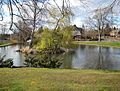
Gannochy duck pond, located at the junction of Annat Road and Dupplin Road.
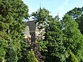
St. Mary's Monastery, Kinnoull


References
- ↑ Perth Bowling at City-Visitor.com
- ↑ "Kinnoull Tennis Club is awarded Clubmark accreditation" - Perthshire Advertiser
This Perthshire article is a stub: help to improve Wikishire by building it up.