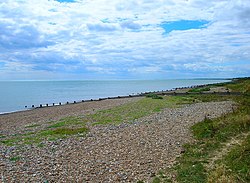
Kingston by Ferring
| Kingston | |
| Sussex | |
|---|---|
 West Kingston Beach, Kingston by Ferring | |
| Location | |
| Grid reference: | TQ085016 |
| Location: | 50°48’15"N, 0°27’42"W |
| Data | |
| Population: | 625 (2011) |
| Post town: | Littlehampton |
| Postcode: | BN16 |
| Dialling code: | 01903 |
| Local Government | |
| Council: | Arun |
| Parliamentary constituency: |
Worthing West |
Kingston or Kingston by Ferring, is a small group of neighbouring hamlets: East Kingston, West Kingston and Kingston Gorse, on the south coast of Sussex, in the little gap between the coastal conurbations of Littlehampton to the west and Worthing to the east. An unbroken beach runs all along the coast between the towns, but while holiday villas line the lane above the shore all the way through East Kingston and Kingston Gorse, they do not connect the two towns other side, and the parish is a green lung breaking the otherwise relentless development of the coastland.
Kingston Gorse and West Kingston are on the seafront adjoining each other, and East Kingston is a few hundred yards inland. Behind the hamlets is a farmed, rural interior.
There is little space between the three hamlets and the swollen towns either side. To the east are Ferring and Goring-by-Sea, attached to Worthing further east, and west of them is East Preston, adjoined to Litlehampton. Kingston is three miles west of Worthing. A generally pedestrianised seafront connects the parish to Littlehampton and to Worthing.
The original village centre including the parish church was lost to the sea around 1630[1] and remains have been found well below the present highwater line.[2]
| ("Wikimedia Commons" has material about Kingston by Ferring) |