Hurst Green, Sussex
| Hurst Green | |
| Sussex | |
|---|---|
 Hurst Green | |
| Location | |
| Grid reference: | TQ733271 |
| Location: | 51°1’12"N, 0°28’12"E |
| Data | |
| Population: | 1,481 (Parish, 2011) |
| Post town: | Etchingham |
| Postcode: | TN19 |
| Dialling code: | 01580 |
| Local Government | |
| Council: | Rother |
| Parliamentary constituency: |
Bexhill and Battle |
| Website: | hurstgreen-pc.gov.uk |
Hurst Green is a village in Sussex, in the east of the county, just a miles south of the border with Kent.
The area is entirely contained within the 'High Weald Area of Outstanding Natural Beauty'.
The village is located on the A21 road, halfway between Tunbridge Wells (mainly in Kent), in the north and Hastings (firmly in Sussex) in the south; about 13 miles each way. The A265 road starts in the village at the A21, previously starting in Hawkhurst.
The wider civil parish includes two hamlets: Silver Hill and Swiftsden.
Contents
Church
The village church is Holy Trinity, a brick-built Church of England parish church
There used to be a Roman Catholic church, of Our Lady Help of Christians, but it has been closed and converted into a community shop, which also contains the village post office.[1]
History
Before the Norman conquest, Hurst Green was part of the parish of Salehurst which belonged to Countess Goda, however it is likely that few people lived in the area.
There is a ridgeway track that runs through Hurst Green via Etchingham to Heathfield, and which was likely to have been in use during the Iron Age.[2]
In 1744 the village green covered a triangular area from the courthouse to the village hall, including land on which some houses in Station Road now stand. "The Cottage" (MES3972) and "Yew Tree" (DES4516) are shown on a map dated 1650, and so must have stood on the edge of the village green.
In the 1870s Hurst Green was described as a "hamlet in Salehurst parish, Sussex; 1½ mile ENE of Etchingham station, and 7 N of Battle. It has a head post office and Iridge Place is adjacent".[3]
The Church of England primary school was originally built in 1862 with an adjacent residence for the master.
The tower and the clock were erected by public subscription in memory of George Burrow Gregory of Boarzell who died 5 March 1892.[4]
In 1952 the civil parish of Hurst Green was created from portions of the parishes of Etchingham, Salehurst and Ticehurst and the ecclesiastical parish was formed in 1907.[5]
By the 1930s, the population of Hurst Green was 628 (counts in 1934 and 1938).
Local legends
- It is possible that the area known locally as Burgh Hill on the south side of the village was the site of a fort built by King Alfred the Great, this is mentioned in the Burghal Hidage (a record of the forts from Alfred's reign) as being called Eorpeburner.
- There are reports of possible tunnels under and around the village that were used by the infamous Hawkhurst Gang that ran between the village and Hawkhurst to enable their smuggling operations. However none have ever been found.
Village organisations
- Bowling: Hurst Green Short Mat Bowls Club
Pictures
| ("Wikimedia Commons" has material about Hurst Green, Sussex) |

Bexhurst Oast, Hurst Green
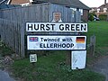
Village sign

Village hall

Old Hurst Green Post Office on the A21

Station Road (A265)


Outside links
- Photos of Hurst Green from the early 20th Century
- Hurst Green Parish Council
- Hurst Green Parish Magazine
References
- ↑ "Community Shop Blog". http://www.hurstgreen.com/blog/index.php.
- ↑ MES4360
- ↑ 1870-72, John Marius Wilson's Imperial Gazetteer of England and Wales
- ↑ Memorial Plaque affixed to Hurst Green Court House
- ↑ Hodson, L.J (1914). A Short History of the Parish of Salehurst, Roberstbridge.